The Road to Canada
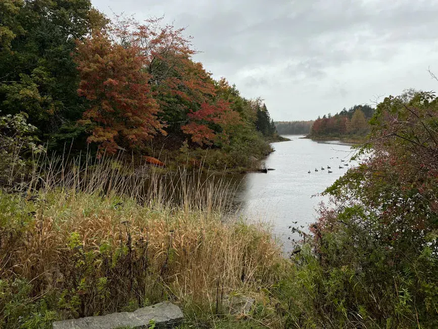
Route 201 runs north from Solon through the heart of the western Maine wilderness, following the Kennebec River for much of its length before crossing the international border into Quebec. It has been a route north for centuries, Native Americans, Benedict Arnold’s 1775 march to Quebec, loggers driving timber down the river, and generations of travelers heading to Canada have all used this corridor. In 2000, it was designated a National Scenic Byway, and the name Old Canada Road stuck.
The 78-mile stretch from Solon to the border at Coburn Gore is one of the loneliest, most beautiful drives in the eastern United States. North of The Forks, a village named for the confluence of the Kennebec and Dead Rivers, the road enters true wilderness. Gas stations disappear. Cell service drops out. The forest closes in on both sides, and the only signs of human presence are the road itself, the occasional logging truck, and the power line that parallels the route.
This is not a drive for checking boxes. There are no major attractions to visit, no museums to tour, no admission fees to pay. The drive itself is the experience, the river, the gorge, the mountains rising on either side, and the vast, unbroken forest that reminds you how much of Maine is still wild.
The Route
The byway begins in Solon, a small town on the Kennebec where Route 201 leaves Route 2 and heads north. The early miles follow the river through rolling farmland and small villages, Bingham, Moscow, Caratunk, before the landscape changes dramatically at The Forks.
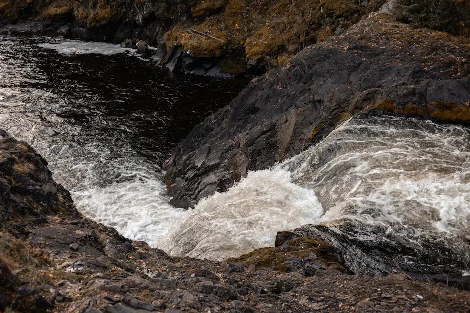
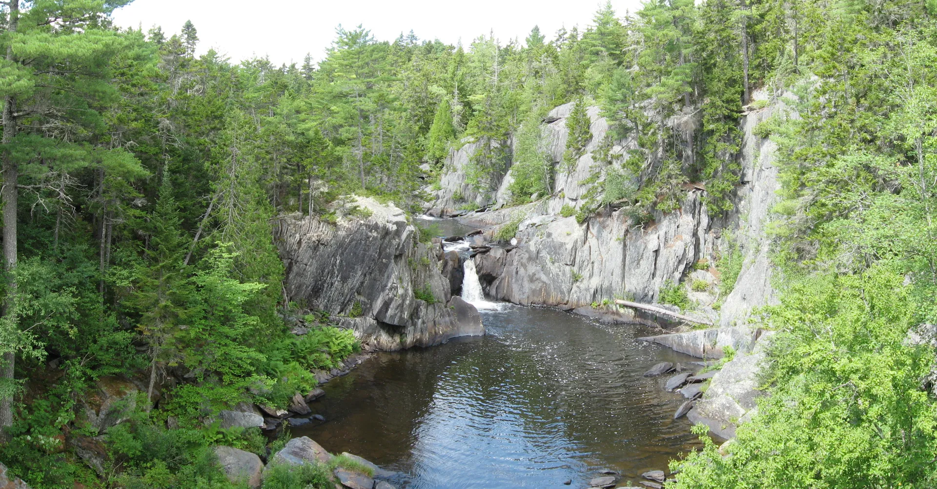
North of The Forks, the Kennebec enters its gorge, and Route 201 climbs above the river, winding through dense spruce-fir forest with occasional pulloffs that offer views down into the canyon. The gorge is steep-walled and dramatic, with the river visible far below as a ribbon of white water.
Several pulloffs between The Forks and Jackman offer views into the Kennebec Gorge. The most dramatic is about 10 miles north of The Forks, where you can see the river hundreds of feet below the road. These are informal pulloffs, not signed or developed, so watch for gravel shoulders and slow down to find them.
The road continues north through Jackman, the last town of any size before the border. Jackman sits on the shore of Wood Pond and serves as a base for hunting, fishing, and snowmobiling. Beyond Jackman, the final stretch to the border is increasingly remote, with Attean Pond and the Moose River valley providing the scenery.
The Forks
The Forks is the hub of the byway, a small village at the confluence of the Kennebec and Dead Rivers that has become the whitewater rafting capital of Maine. Several outfitters operate from The Forks, running trips down the Kennebec Gorge (Class III-IV rapids released from Harris Dam) and the Dead River (Class III-V during spring and fall releases).
Even if you are not rafting, The Forks is worth a stop. The village has a few restaurants, lodges, and a general store. The confluence itself, where the Dead River pours into the Kennebec, is visible from the Route 201 bridge and is a powerful sight, especially during high water.
If you want to experience the Kennebec Gorge without rafting, book a raft trip on one of the gentler sections offered by some outfitters, or hike to Moxie Falls, Maine’s tallest waterfall, which is a short detour from The Forks. The 90-foot falls are less than a mile hike from the parking area and are spectacular in spring and early summer.
Benedict Arnold’s March
In September 1775, Benedict Arnold led 1,100 soldiers up the Kennebec River in a disastrous attempt to invade Quebec. The expedition followed the river through the gorge, portaged around rapids, and crossed the Height of Land into Canada. The soldiers faced starvation, disease, and brutal weather. Many deserted or died. Those who survived reached Quebec City in terrible condition and launched an unsuccessful attack on New Year’s Eve.
Historical markers along Route 201 trace the route of Arnold’s march. The most significant is near The Forks, where the expedition turned up the Dead River toward Canada. It is sobering to look at the dense forest and realize that 1,100 men dragged heavy boats through this wilderness in October and November, with winter closing in.
When to Go
Summer
Best driving weather and longest days. Whitewater rafting season. The Forks and Jackman are active. Warm enough for outdoor exploring.
Fall
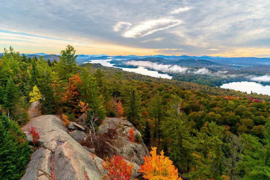
Peak foliage makes this one of the finest fall drives in New England. The gorge views are spectacular with color. Rafting continues into October. Moose are more visible.
Winter
The road is maintained but can be icy and snowy. Jackman is a snowmobile hub. The landscape is stark and beautiful. Carry emergency supplies and drive carefully.
Spring
Spring runoff swells the rivers. The gorge is at its most powerful. Roads can be muddy on shoulders. Blackflies arrive in May.
North of The Forks, gas stations and services are very limited. Fill your tank before leaving Bingham or The Forks. Cell service is unreliable or absent for much of the northern section. Carry water, snacks, and an emergency kit. In winter, carry cold-weather supplies and be prepared for road closures.
Side Trips
- Moxie Falls: A 10-minute detour from The Forks to Maine’s tallest waterfall (90 feet). Short hike, big payoff.
- Attean Pond: North of Jackman, this remote pond is accessible by a dirt road and offers exceptional moose-watching at dawn and dusk.
- Parlin Pond: Between The Forks and Jackman, with a public boat launch and mountain views.
- Boundary Bald Mountain: Near Jackman, a moderate hike with views into Canada.
FAQ
How long does the Old Canada Road Scenic Byway take to drive?
The 78 miles from Solon to the Canadian border take about 1.5 to 2 hours of driving without stops. Plan 3 to 4 hours to enjoy the pulloffs, side trips, and scenery. A full day if you add activities like Moxie Falls or rafting.
Is Route 201 paved the whole way?
Yes. Route 201 is a fully paved, two-lane highway maintained year-round. It is the main road to the Canadian border crossing at Coburn Gore.
Can you see moose on the Old Canada Road?
Yes. The northern sections between The Forks and Jackman are prime moose habitat. Dawn and dusk are the best times for sightings, especially near ponds and marshy areas. Drive carefully, moose on the road are a serious collision hazard.
Do you need a passport for the Old Canada Road?
Only if you plan to cross into Canada at the Coburn Gore border crossing. The scenic byway itself is entirely in Maine and requires no documentation.
Is there cell service on Route 201?
Service is available in the towns (Solon, Bingham, The Forks, Jackman) but drops out between them. The section north of The Forks has very limited coverage. Do not rely on your phone for navigation, bring a paper map or download offline maps before the drive.