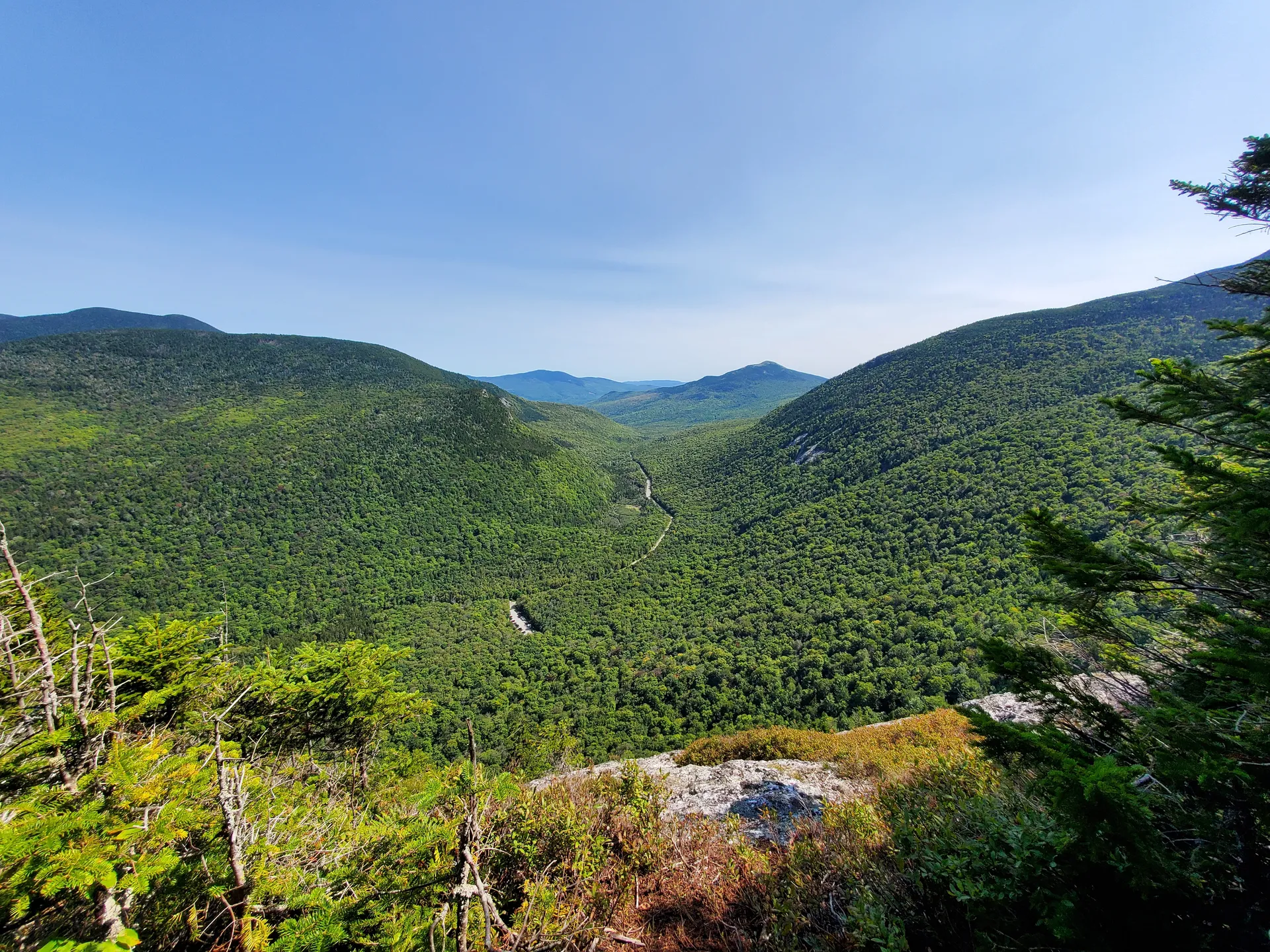
A Granite Balcony Over the Notch
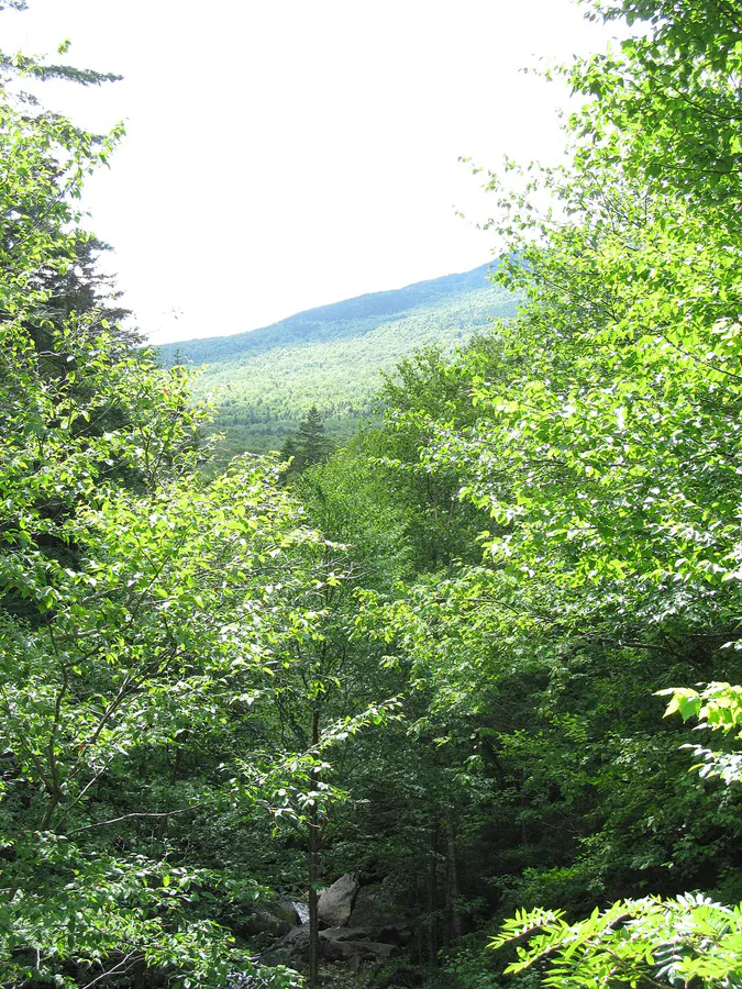
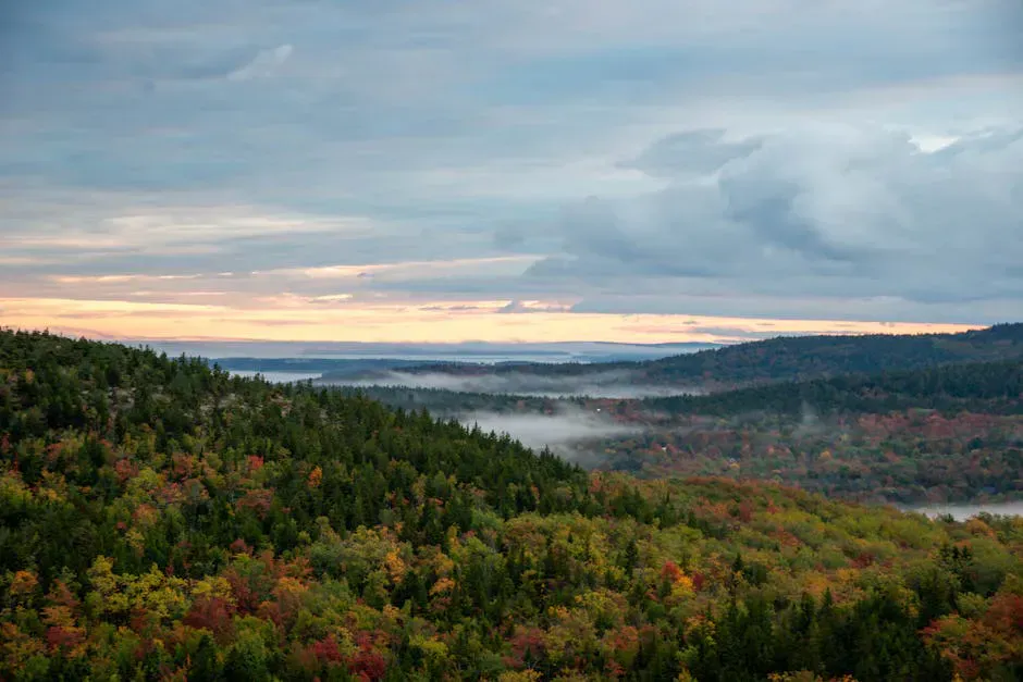
Table Rock is a broad, flat granite ledge that juts out from the flank of Baldpate Mountain in Grafton Notch State Park, roughly 900 feet above the notch floor. From its edge, you look straight across the gap to Old Speck Mountain, the third-highest peak in Maine at 4,170 feet, and down into the deep U-shaped valley carved by glacial ice thousands of years ago. The Eyebrow cliff hangs on the opposite wall, a dark band of rock above the forest canopy. It is one of the most dramatic overlooks in the state, and reaching it requires a short but demanding hike through one of the most interesting trail systems in western Maine.
Grafton Notch itself is a mountain pass along Route 26 between Newry and Upton, carved by glaciers during the last ice age. The notch walls rise steeply on both sides, with Old Speck to the west and Baldpate Mountain to the east. The Appalachian Trail crosses through the notch here, and Table Rock sits right on the AT corridor, making it one of the most accessible viewpoints on the entire Maine section of the trail.
The Hike
The Table Rock Trail is a 2.4-mile loop that begins at the Appalachian Trail parking area on Route 26. From the parking area, cross Route 26 and pick up the white-blazed AT heading northbound. After about 0.1 miles, you reach a junction where the orange-blazed Table Rock Trail splits off to the right.
The direct route via the Table Rock Trail is the steeper option. The trail climbs aggressively through boulders and switchbacks, with several sections requiring hand-over-hand scrambling over and between large rocks. A highlight is the “lemon squeezer,” a narrow passage between massive boulders that you must squeeze and climb through. The passage is fun but not suitable for people uncomfortable with tight spaces or young children.
The alternative is to continue on the AT, which takes a more moderate route to the same junction near the summit. The AT approach is longer but less steep and avoids the boulder scrambling. Most hikers go up the Table Rock Trail and descend via the AT to complete the loop.
The View from Table Rock
Table Rock itself is a flat granite platform roughly 30 by 50 feet, tilted slightly toward the notch. There are no railings or barriers. You sit or stand on open granite with the notch falling away below you and Old Speck rising across the gap.
The view is best in three directions:
- West: Old Speck Mountain fills the skyline, its summit fire tower sometimes visible. The Eyebrow cliff band is directly across the notch.
- South: The notch opens toward Newry and the Bear River valley. Route 26 is visible far below as a thin gray line.
- North: The Baldpate ridgeline continues above Table Rock toward the twin summits of Baldpate East and Baldpate West.
On clear days, the view extends south to the Presidential Range in New Hampshire. In fall, the hardwood forest in the notch turns brilliant orange and red while the spruce-fir zones on the upper slopes remain dark green, creating dramatic contrast.
The Boulder Caves
Below Table Rock, the trail passes through a network of boulder caves formed by massive blocks of granite that tumbled from the cliff face and piled against each other. These are talus caves, not true caves, but some of the passages extend 20 to 30 feet in darkness and require ducking, climbing, and squeezing. They retain cool air and sometimes ice well into summer. Exploring them adds an adventurous element to the hike but requires a headlamp and careful footing.
When to Go
Summer
Best weather for the scramble. Bring plenty of water as the trail is exposed in sections. Afternoon thunderstorms can develop quickly in the mountains. Start early.
Fall
The prime season. Foliage in Grafton Notch is spectacular, and the contrast between hardwoods and spruce is best seen from Table Rock. Peak color is late September to early October.
Spring
Trail can be muddy and the boulder sections slippery with snowmelt. Wait until late May or June for the best conditions. Black flies are fierce.
Winter
The trail is not maintained. Ice and snow make the boulder scramble dangerous. Winter ascents require crampons, ice axes, and experience. Not recommended for casual visitors.
Getting There
From the intersection of Route 2 and Route 26 in Newry, follow Route 26 north approximately 12 miles into Grafton Notch. The AT parking area is on the left (east) side of the road, well-marked with a sign. The parking lot holds about 20 vehicles. From Portland, the drive takes about 2 hours via the Maine Turnpike and Route 26. From Bangor, about 2 hours and 45 minutes via Route 2.
GPS coordinates for the trailhead: 44.5878, -70.9360
FAQ
How difficult is the hike to Table Rock?
The trail is rated moderate to difficult. The direct route via the orange-blazed Table Rock Trail involves steep scrambling over and between large boulders, including a narrow squeeze passage. The AT alternative is longer but less steep. The loop is 2.4 miles total with 900 feet of elevation gain.
Is Table Rock suitable for children?
Not for young children. The boulder scramble requires agility and comfort with heights. Older children and teenagers who are experienced hikers may enjoy it. The AT route is a better option for families.
Are dogs allowed on the Table Rock Trail?
Dogs are technically allowed in the state park but are not recommended on the Table Rock Trail due to the steep scrambling and boulder passages. Some sections are physically impossible for most dogs.
Is there a fee to hike Table Rock?
Grafton Notch State Park charges a day-use fee of $4 for Maine residents and $6 for non-residents. The fee is collected at the parking area.
Can I continue from Table Rock to Baldpate Mountain?
Yes. The Appalachian Trail continues from the Table Rock area north along the Baldpate ridgeline to East Baldpate (3,812 feet) and West Baldpate. This adds significant distance and elevation and makes for a strenuous full-day hike.