A Swimming Hole You Have to Search For
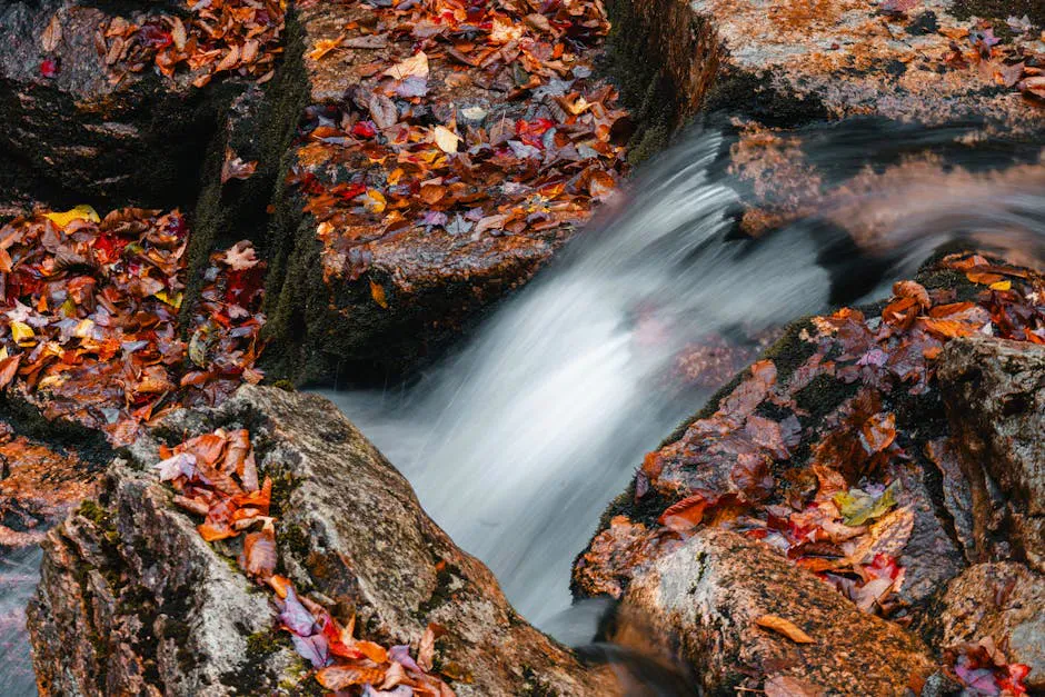
Kezar Falls Gorge is not marked on most tourist maps and there are no signs directing you to it. The parking area is a small dirt pulloff on a back road in Lovell, and the trail is more of a short scramble down a wooded slope than a maintained path. That is precisely what makes it special. The Kezar River drains Five Kezar Ponds and drops over a ledge here before flowing through a sculpted gorge roughly 50 meters long, carved into bedrock by thousands of years of moving water.
The gorge walls are shaped into smooth curves, deep potholes, and narrow channels. These potholes connect to form pools of varying depth, some suitable for swimming and others for wading. The water is clear and cold, fed by the ponds upstream. On a hot summer day, this is one of the best swimming holes in western Maine, and the effort required to find it keeps the crowds small.
The waterfall itself is about 20 feet tall, modest by Maine standards. But the gorge below it is the real attraction. The water has carved the rock into shapes that look almost sculpted by hand, with smooth bowls, rounded channels, and narrow slots where the current picks up speed. The geological work on display here is striking for such a quiet, tucked-away spot.
Getting to the Falls
The walk from the parking area to the falls is about 0.1 miles. It is a short scramble down a wooded slope to the river, not a maintained trail with signage and boardwalks. The footing is uneven, with roots, loose dirt, and some rock, so hiking boots with a grippy sole handle the steep descent better than sandals. It is manageable for most people, but not suitable for strollers or wheelchairs. The descent is steep enough that very young children or those with mobility issues should use caution.
The parking area is the hardest part to find. It is off Five Kezars Road, which becomes a dirt road. Look for a small pulloff that is fed by three short access roads. There are no signs. Using GPS coordinates and a satellite map beforehand will save you considerable time.
The rocks in the gorge are slippery, especially near the waterfall. Water shoes or sandals with grip are essential. The depth of the potholes varies, and some pools are deeper than they appear. Test the depth before entering any pool, and never dive headfirst into water you have not checked. The gorge walls are steep in places, and chain link fencing has been installed in some areas for safety.
Swimming
The connected potholes in the gorge form natural swimming pools of varying depth. Some are waist-deep, others are over your head. In summer, the water temperature is cold but tolerable, warmed slightly by the shallow ponds upstream. The current through the gorge can be stronger than it looks, especially after rain or during spring runoff.
Most visitors come to swim, sunbathe on the rocks, and enjoy the privacy of the spot. There are flat rock ledges along the gorge that work as natural sunning platforms, and a compact daypack makes it easy to carry your towel, water, and snacks down the scramble for an afternoon. People have been coming here for generations, and the local knowledge of the spot has kept it relatively uncrowded compared to more publicized swimming holes.
The gorge walls are steep, and the waterfall itself is not climbable, which limits risk from that direction. However, the slippery rock surfaces and variable pool depths mean you need to move carefully throughout the gorge.
The rocks in and around the gorge are smooth from water action but very slippery when wet. Regular sandals or bare feet will leave you sliding. Water shoes with rubber soles make navigating the gorge much safer and more enjoyable. This is not optional gear.
When to Go
Summer
The only season where swimming is comfortable. Water warms up by late June. Best on hot weekday afternoons when you may have the spot to yourself.
Fall
Beautiful setting with foliage, but the water is too cold for most swimmers. Good for photography.
Spring
High water from snowmelt makes the falls more dramatic but swimming is dangerously cold and the current is strong. Worth a look but not a swim.
Winter
Accessible but the road may be rough. Ice formations on the falls can be scenic. Not a swimming destination.
Late June through August is the window for swimming. The water needs sustained warm weather to reach tolerable temperatures. Even then, it is a mountain-fed stream and will never feel warm. Weekday afternoons offer the best chance of having the gorge to yourself.
Spring brings the most dramatic water flow over the falls, but the current in the gorge is too strong and cold for safe swimming. Fall foliage creates a beautiful backdrop for photography, with hardwoods lining the river turning orange and gold.
Practical Notes
Kezar Falls Gorge is a local spot, not a tourist attraction. There are no trash cans, no restrooms, and no services. Pack out everything you bring in, and leave the gorge as you found it. The locals who have been swimming here for decades would appreciate it.
Nearby
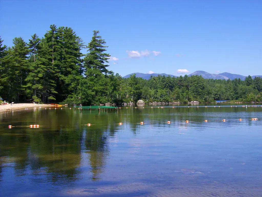
Kezar Lake is a short drive from the falls and offers some of the clearest water in Maine for swimming, paddling, and fishing. The town of Lovell itself is a quiet Western Mountains community without much in the way of restaurants or shops. The nearest full services are in Fryeburg (about 20 minutes south) or Bridgton (about 30 minutes southeast).
Packing List
Kezar Falls Gorge Visit
- Water shoes with rubber soles (mandatory for the slippery gorge rock)
- Towel and swimsuit
- Camera (the gorge is photogenic)
- Water and snacks (no facilities anywhere nearby)
- Sunscreen
- Downloaded GPS coordinates and satellite map (no signs to guide you)
- Trash bag (pack out everything)
Getting There
From North Waterford, take Five Kezars Road north. The road becomes dirt after a short distance. Watch for a small parking pulloff on the left that is fed by three short access roads. The pulloff is not signed and easy to miss. From the pulloff, a short scramble through the woods leads down to the river and the gorge.
From Portland, take Route 302 west to Bridgton, then Route 37 north to Waterford, then Valley Road to Five Kezars Road. The drive takes about 2 hours. From Bangor, expect about 3 hours and 15 minutes.
GPS coordinates: 44.1951, -70.8190
FAQ
Can you swim at Kezar Falls Gorge?
Yes. The gorge below the falls has natural potholes deep enough for swimming in summer. Water shoes are essential. The water is cold, fed by Five Kezar Ponds upstream.
Is Kezar Falls Gorge hard to find?
Yes. There are no signs, and the parking area is an unmarked dirt pulloff on a dirt road. GPS coordinates and a satellite map are highly recommended. The walk to the falls is only about 0.1 miles but is not a maintained trail.
Is there a fee for Kezar Falls Gorge?
No. There are no fees, no permits, and no formal facilities. This is an informal local swimming spot, not a managed park.
How deep is the water at Kezar Falls Gorge?
Depth varies. Some potholes in the gorge are waist-deep, while others are over your head. Always check the depth before entering any pool. Conditions change with water levels.
When is the best time to visit Kezar Falls Gorge?
Late June through August for swimming. The water needs warm summer weather to be tolerable. Spring offers the highest water flow but is too cold and fast for safe swimming.