A Tall Cascade in Evans Notch
Mad River Falls is one of the more impressive waterfalls in western Maine, dropping roughly 70 feet in a series of horsetail cascades through a steep, forested ravine in the White Mountain National Forest. The falls are located in Batchelders Grant, an unorganized township in Oxford County, about a mile east of the New Hampshire border in the Evans Notch area.
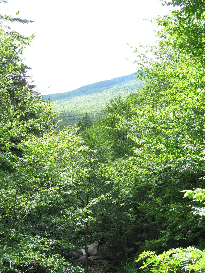
The cascade is partially hidden behind trees and the ravine walls, which adds to its mystique. You hear the falls well before you get a clear view, and the glimpses through the forest canopy suggest something larger and wilder than the typical Maine stream cascade. Getting a full view requires some effort, but the scale of the falls makes the hike worthwhile.
The Hike
The trail to Mad River Falls follows the yellow-blazed Royce Trail, which departs from a parking area on Route 113 in Evans Notch. From the trailhead, follow the Royce Trail generally north. After about 0.3 miles, the trail passes through a field clearing where it forks right. Continue following the yellow blazes.
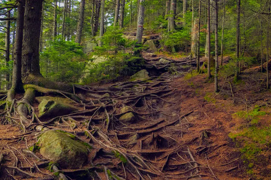
The falls are approximately 1.6 miles from the trailhead. The trail climbs steadily through mixed forest, gaining roughly 500 feet of elevation. The footing is roots and rocks throughout, with a few steeper sections, so supportive hiking boots help on the uneven climb. This is a moderate hike that takes most people about an hour each way.
The best views of the falls come from the trail itself, where openings in the trees provide vantage points across the ravine. Scrambling closer to the falls is not recommended. The terrain near the base is steep, loose, and dangerous.
The ravine walls near Mad River Falls are steep and unstable. Attempting to scramble down for a closer view is dangerous and has resulted in injuries. Stay on the trail and use the viewpoints where the trees open up.
The Falls
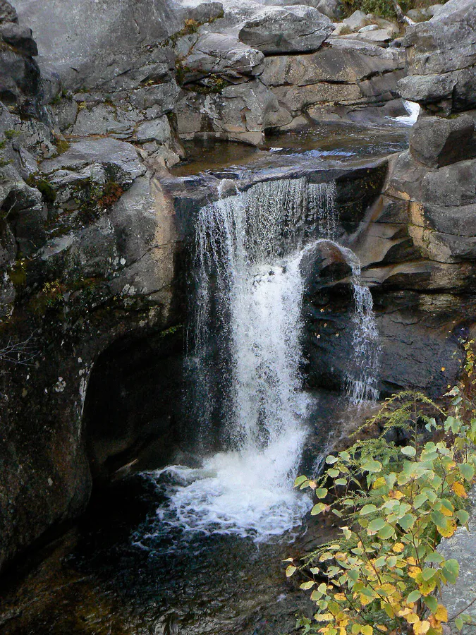
The cascade drops in a long series of horsetails and slides down the rock face, with the water fanning out and narrowing as it passes over different ledge formations. The total drop covers roughly 70 feet, making this one of the taller waterfalls in the Evans Notch region. The rock is dark granite and gneiss, and the ravine is lined with spruce, birch, and hemlock.
In spring, the flow is strong and the cascade fills the ravine with sound. By late summer, the volume drops significantly and the upper sections may thin to a trickle. Early season visits are more dramatic, but the hike is more pleasant in dry conditions later in summer.
Photography is challenging because the falls are partially obscured by trees and the viewpoints are limited. A telephoto lens helps isolate sections of the cascade. Morning light reaches the falls from the east, which provides the best conditions.
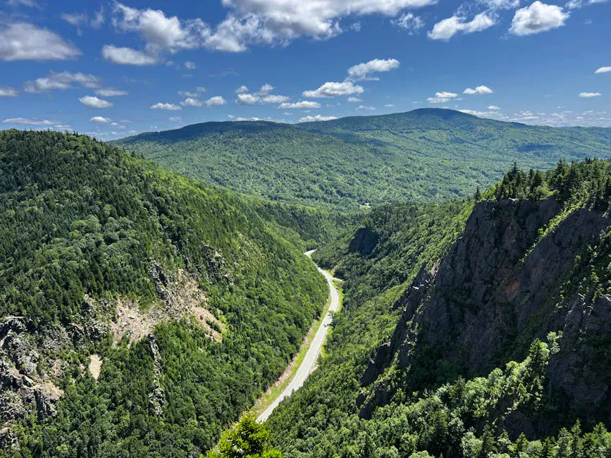
If you have the energy, the Royce Trail continues past the falls to the summit of East Royce Mountain, which offers panoramic views of Evans Notch and the surrounding peaks. The summit adds about 2 miles and 1,000 feet of climbing to your day. The views are outstanding.
When to Visit
Spring
Peak water flow. Trail may be muddy and snow patches linger at higher elevations into May.
Summer
Best trail conditions. Water flow decreases through the season. Good hiking weather.
Fall
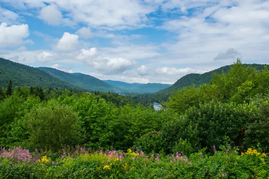
Fall foliage in Evans Notch is outstanding. Cool hiking temps. Moderate water flow.
Winter
Route 113 through Evans Notch is closed in winter. Access would require a long approach from an alternate route.
Route 113 through Evans Notch is closed from roughly December through April, which limits winter access to the trailhead. The best window for visiting runs from mid-May through mid-October. Fall foliage in Evans Notch peaks in late September and early October and is considered some of the best in western Maine.
Evans Notch is the least-visited notch in the White Mountains, which means you get the scenery without the crowds. If you are used to the parking chaos at Franconia or Crawford Notch in New Hampshire, Evans Notch will feel like a different world. The Royce Trail parking area rarely fills up.
Practical Notes
There are no fees or permits required. The Royce Trail parking area has room for a dozen cars. There are no restrooms at the trailhead, and the nearest services are in Bethel, about 20 minutes south, so carry water, snacks, and a rain layer in a comfortable daypack for the round trip.
Dogs are allowed on the trail and should be leashed. The trail is not suitable for strollers or wheelchairs.
Packing List
Mad River Falls Hike
- Hiking boots (rocky, rooty trail)
- Water (at least 1 liter for the round trip)
- Camera with telephoto lens (falls are partially obscured)
- Bug spray (May through July)
- Rain jacket
- Snacks
Getting There
Mad River Falls is in Batchelders Grant, an unorganized township in Oxford County about a mile east of the New Hampshire border. Bethel is the nearest town with full services, roughly 20 minutes south of the trailhead. Fuel up and grab supplies there before heading into Evans Notch.
The trailhead is on Route 113, the scenic road that winds through Evans Notch within the White Mountain National Forest. Look for the Royce Trail parking area along Route 113. It is a free gravel lot with room for roughly a dozen cars and rarely fills up, even on summer weekends. There are no restrooms at the trailhead.
From the parking area, follow the yellow-blazed Royce Trail generally north. After about 0.3 miles the trail passes through a clearing and forks right, continue following the yellow blazes. The falls are roughly 1.6 miles from the trailhead, with about 500 feet of elevation gain. GPS coordinates for the falls are approximately 44.3150, -70.9700.
Route 113 through Evans Notch closes in winter, typically from roughly December through April. Check with the White Mountain National Forest for current road status before planning a shoulder-season visit. Cell service in the notch is unreliable, so download offline maps before leaving Bethel.
FAQ
How tall is Mad River Falls?
Mad River Falls drops roughly 70 feet in a series of horsetail cascades through a forested ravine. It is one of the taller waterfalls in the Evans Notch area.
How long is the hike to Mad River Falls?
The trail is about 1.6 miles each way (3.2 miles round trip) on the Royce Trail. Allow about two to three hours for the round trip including time at the falls.
Can you get close to Mad River Falls?
The best views are from the trail. Scrambling into the ravine for a closer view is dangerous and not recommended. The terrain near the base is steep and unstable.
Is Route 113 open year-round?
No. Route 113 through Evans Notch closes in winter, typically from December through April. Check with the White Mountain National Forest for current road status.
Can I combine Mad River Falls with other hikes in Evans Notch?
Yes. The Royce Trail continues to the summit of East Royce Mountain, and there are several other trails in Evans Notch including Caribou Mountain and Speckled Mountain. A full day in Evans Notch can include the falls and a summit.