A Hidden Cascade in the North Woods
Otter Falls drops roughly 15 feet on Otter Brook in Township 4 R11 WELS, deep in the unorganized territories of Piscataquis County. This is not a waterfall you stumble on by accident. Getting here requires navigating a network of logging roads south of the Debsconeag Lakes, and the reward is a small but scenic cascade surrounded by unbroken forest with almost no chance of seeing another person.
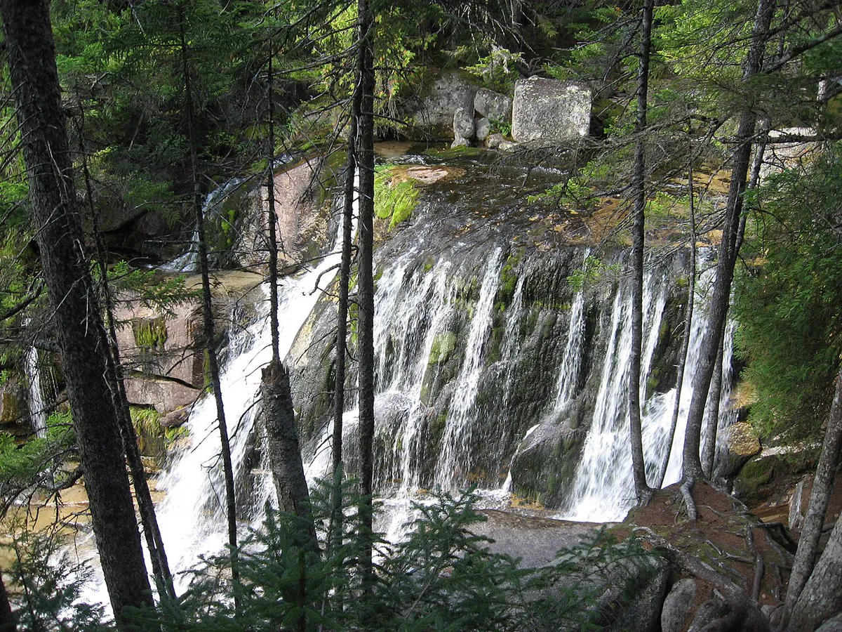
The brook tumbles over a series of ledges into a pool shaded by spruce and fir. The falls are modest in height compared to the big-name cascades elsewhere in Maine, but the setting is what makes this place worth the effort. There is no development, no signage beyond what loggers have left behind, and no cell service. You are on your own out here.
This waterfall is deep in Maine’s unorganized territories. There is no cell service, no marked trail, and no emergency services nearby. Do not attempt this trip without a detailed map, a GPS device, and experience navigating logging roads. Tell someone your plans before you go.
Getting to the Falls
The approach starts from Millinocket, the nearest supply town. Head west on the Golden Road or take logging roads south toward the Debsconeag Lakes region. The specific route depends on current road conditions and gate access, which can change seasonally as timber companies open and close sections. A DeLorme Maine Atlas & Gazetteer is essential for navigation in this area.
From the nearest pulloff on the logging road, the walk to the falls follows Otter Brook through mixed forest. There is no maintained trail. You will be bushwhacking along the brook for roughly a mile, picking your way through blowdowns and moss-covered rocks. The terrain is not technically difficult, but it is slow going. Allow at least an hour each way and wear waterproof hiking boots that can handle wet, uneven ground.
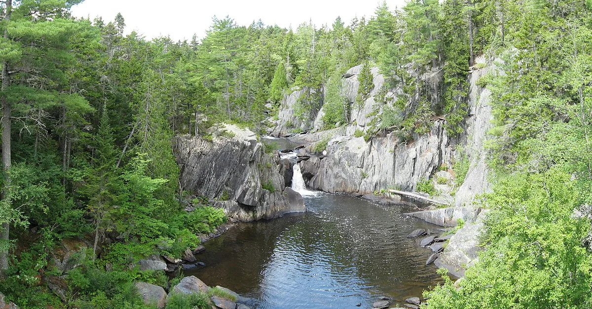
The brook itself serves as your guide. Follow it upstream and you will hear the falls before you see them. The cascade appears where the brook drops over a bedrock ledge into a shallow gorge.
If you are already making the drive to this area, consider spending a full day exploring the Debsconeag Lakes region. First, Second, and Third Debsconeag Lakes are remote ponds with excellent brook trout fishing and primitive campsites. Otter Falls makes a good side trip on a longer backcountry outing.
The Falls
The main drop is a single plunge of about 15 feet over a dark ledge into a pool below. In spring, snowmelt from the surrounding hills pushes the flow up significantly, and the cascade fills the gorge with sound. By midsummer, the volume drops and the falls thin out, though they still run. The ledge rock is dark slate and granite, and the surrounding forest is dense enough that the falls sit in dappled shade for most of the day.
The pool at the base is not deep enough for swimming but holds brook trout in the colder months. Fly anglers who make the trek sometimes fish the pools above and below the falls, though the dense streamside brush makes casting challenging.
When to Visit
Spring
Peak water flow from snowmelt. Black flies are fierce in June. Logging roads may be soft or muddy.
Summer
Drier access roads and warmer weather. Water flow decreases through July and August.
Fall
Foliage color in the hardwoods. Cooler temperatures and fewer bugs. Roads close by late October.
Winter
Logging roads are typically gated. Snowshoe access is possible but very remote. Not recommended for most visitors.
Late May through June brings the strongest flow, but also the worst black flies in this part of Maine, so a head net and strong bug and tick protection are essential for an early-season trip. July and August offer easier road conditions and warmer weather at the cost of reduced water volume. September brings color to the hardwoods along the brook and cooler hiking temperatures.
The logging roads in this area are active during the week. Loaded trucks have the right of way and move fast on narrow roads. Pull over completely when you hear one coming. On weekends, traffic is lighter and driving is more relaxed.
Practical Notes
There are no fees, no permits, and no facilities of any kind at or near the falls. Pack everything you need, including water, food, a first aid kit, and bug protection. The nearest gas station and supplies are in Millinocket, which is at least an hour away by logging road.
Dogs are welcome but should be leashed near the falls, where the footing is slippery. The brook bank is steep in places.
Packing List
Otter Falls Trip
- GPS device or detailed topo map (no cell service)
- Waterproof hiking boots
- Bug spray and head net (essential May through July)
- Water and snacks for a half-day outing
- First aid kit
- Camera
- Rain gear (weather changes fast in the mountains)
Getting There
Otter Falls is deep in the unorganized territories of Piscataquis County, in Township 4 R11 WELS south of the Debsconeag Lakes. Millinocket is the nearest supply town and the starting point for the approach. Fuel up, stock up on water and food, and plan your route in Millinocket before heading out. There are no services between town and the falls.
From Millinocket, the route heads west on the Golden Road or south along logging roads toward the Debsconeag Lakes region. The specific path depends on current road conditions and gate status, which change seasonally as timber companies open and close sections. A DeLorme Maine Atlas & Gazetteer is essential; do not rely on phone GPS, which can be unreliable or nonexistent out here.
From the nearest logging road pulloff, there is no maintained trail. You follow Otter Brook upstream through mixed forest for roughly a mile, bushwhacking over blowdowns and moss-covered rocks. The brook itself is your guide, follow the sound of water upstream until you reach the cascade. GPS coordinates for the falls are approximately 45.8350, -69.0750.
Logging roads in this area are active during the week, with loaded trucks that have the right of way. Pull over completely when you hear one coming. Roads are typically gated or impassable in winter, and spring mud season can make them difficult even for high-clearance vehicles. Cell service is nonexistent throughout the area, so tell someone your plans, carry a paper map, and bring a GPS device you can trust.
FAQ
How tall is Otter Falls?
Otter Falls drops approximately 15 feet over a bedrock ledge into a pool on Otter Brook. It is a modest cascade, but the remote setting makes it worth visiting.
Is there a trail to Otter Falls?
No. There is no maintained trail. You follow Otter Brook upstream from the nearest logging road, bushwhacking through forest for roughly a mile. Navigation skills and a GPS or topo map are required.
Can you swim at Otter Falls?
The pool at the base is shallow and not suitable for swimming. The water is cold year-round.
Do I need a permit to visit Otter Falls?
No permits are required. The area is on public land in Maine's unorganized territories.
When is the best time to visit Otter Falls?
Late May and June for the strongest water flow. July and August for easier access and fewer bugs. September for fall color.