A Geology Lesson You Can Walk To From Your Car
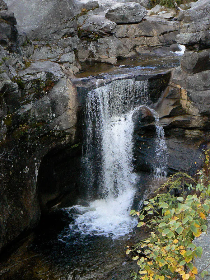
Screw Auger Falls sits right along Route 26 in Grafton Notch State Park, about a mile past the park’s eastern entrance near Newry. The Bear River drops 23 feet through a narrow gorge it has carved through bedrock over thousands of years, creating a series of spiral potholes, chutes, and pools that look like they belong in a geology textbook. The name comes from the screw-like spiral pattern the water has worn into the rock, resembling the bore of an old-fashioned auger tool used for drilling holes.
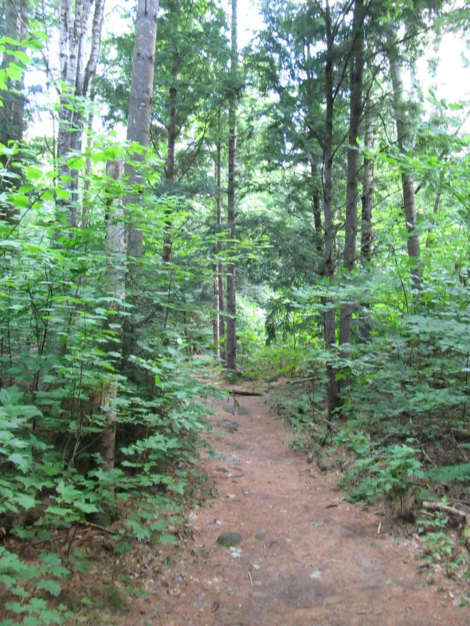
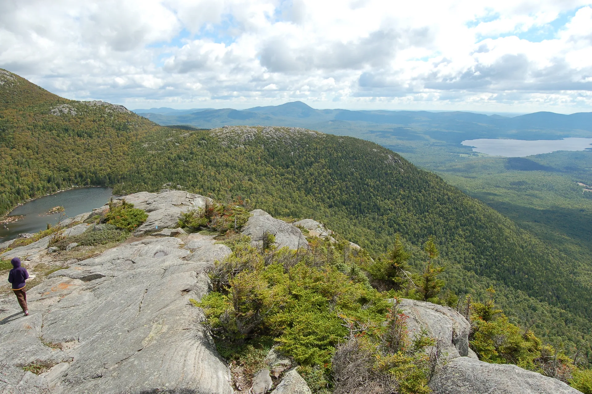
What makes this place remarkable is how little effort it takes to see something extraordinary. You park in the lot on Route 26, walk about 100 yards down a well-maintained path with guard rails, and you are standing above a gorge with swirling water, polished rock formations, and natural swimming holes. No gear required. No fitness test. Families with small children, visitors with limited mobility, and anyone who just wants to see a beautiful waterfall without committing to a hike can enjoy this spot.
The rocks around the gorge and swimming holes are polished smooth by the river and are extremely slippery when wet. Wear shoes with good grip if you plan to explore below the main viewing area. Several visitors have been injured slipping on the wet ledges. Watch children closely near the water.
The Falls and the Potholes
The main drop is 23 feet, but the real attraction is what the water has done to the rock over millennia. The Bear River has carved deep, circular potholes into the granite, some of them several feet across and perfectly round. These formed through pothole erosion, where trapped stones and gravel spin in eddies, grinding circular depressions into the bedrock. Some of the potholes here are textbook examples of this geological process, and interpretive signs at the site explain the science.
The spiral pattern that gives the falls its name is visible in the walls of the gorge. The water has scoured a twisting, corkscrew-shaped channel through the rock, and the polished surfaces catch the light in ways that make the stone look almost liquid. Geologists and casual visitors alike find these formations fascinating.
Below the main falls, the gorge opens up into wider pools and continues downstream through more cascades, potholes, and grottoes. This downstream section is where the swimming happens.
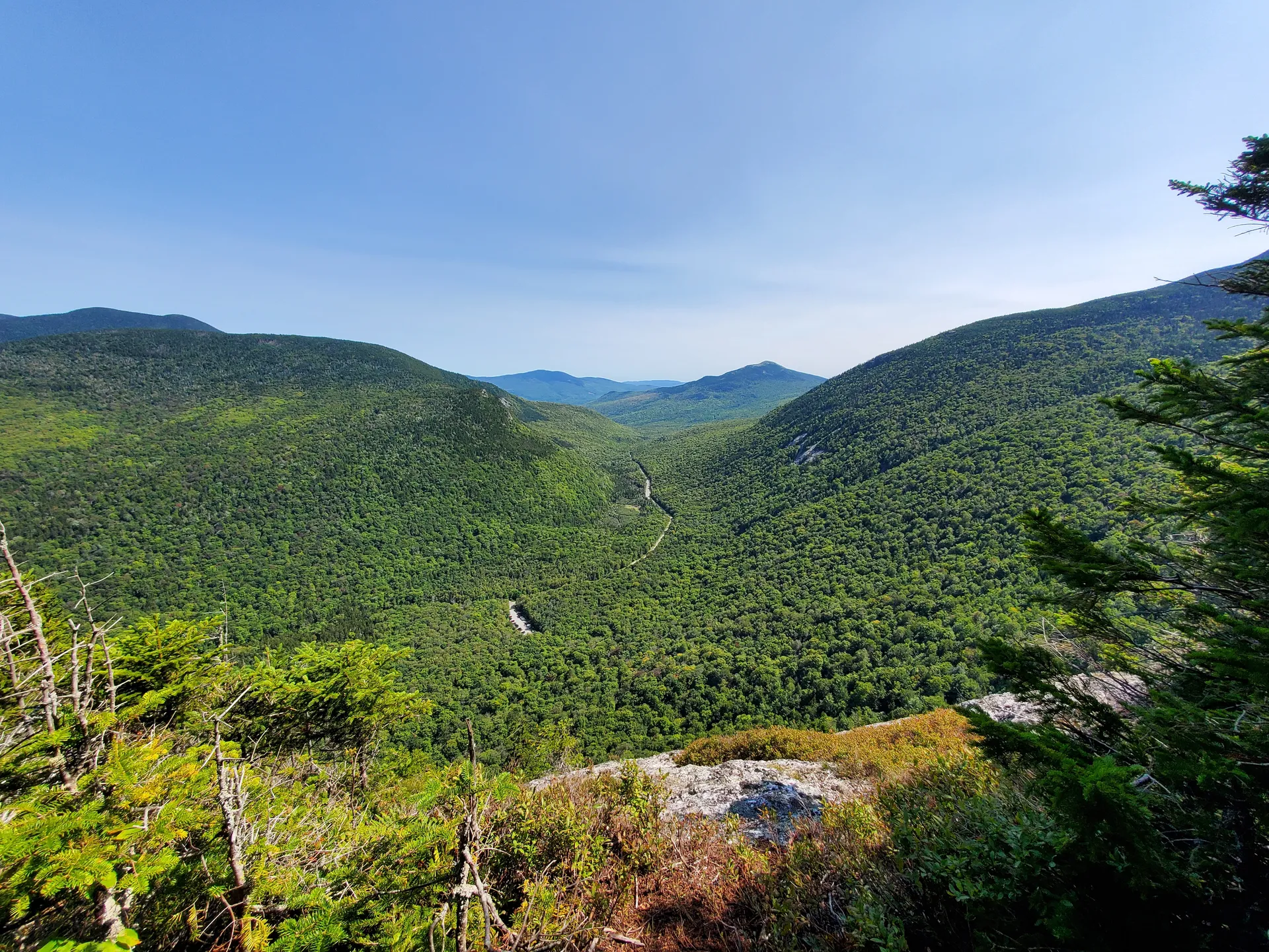
Screw Auger Falls is just one of several geological attractions along Route 26 in Grafton Notch. Within a few miles you can also visit Mother Walker Falls (a narrow slab waterfall), Moose Cave (a deep rock gorge), and the Spruce Meadow picnic area. All have short, easy paths from roadside parking areas. Add Step Falls Preserve, about a mile south of the park, for a full day of waterfalls with almost no hiking.
Swimming at Screw Auger Falls
The pools below the main falls are the primary draw in summer. The deepest pools sit downstream of the cascade, where the river widens and slows. On a warm weekend, families spread out on the rock ledges with towels and coolers, and children wade in the shallower pools while adults brave the deeper, colder water.
The water temperature stays cold through the season, typically in the upper 50s to low 60s even in August. It is refreshing, not warm. Water shoes or sport sandals with rubber soles are essential on the polished granite, and grippy hiking boots are worth packing if you plan to clamber over the slick ledges to the downstream pools. Do not go barefoot. The rock is slick enough that even dry surfaces can be tricky.
There are no lifeguards. The depth varies depending on water levels, and submerged rocks can be hard to see. Wade in gradually and check the depth before jumping or diving. The deepest natural pools are downstream of the main viewing area.
When to Go
Spring
Highest water volume makes the falls dramatic. Too cold for swimming. Park opens May 15.
Summer
Warm enough for swimming. Full facilities open. Popular on weekends. Water still flowing well.
Fall
Foliage in the notch is spectacular. Water levels lower, which makes the potholes easier to see and photograph.
Winter
Route 26 through Grafton Notch is closed in winter. The park is inaccessible by car.
Summer is prime season if swimming is your goal. July and August offer the warmest air temperatures, and while the water never gets truly warm, the combination of sun-heated rock and cold pools is part of the appeal. Weekends get busy. Midweek visits are significantly quieter.
Spring brings the highest water volume and the most powerful falls. Snowmelt from the surrounding mountains feeds the Bear River heavily through May and into June. The water is too cold for comfortable swimming and the rocks are especially slippery, but the falls are at their most dramatic.
Fall foliage in Grafton Notch is outstanding. The narrow valley funnels color, and the hardwoods surrounding the falls turn brilliant orange and gold in late September. Water levels are lower, which reveals more of the pothole formations and makes the geology easier to appreciate.
Grafton Notch State Park charges a day-use fee for out-of-state vehicles ($4 per adult, $1 for children 5-11). Maine-registered vehicles enter free. The fee station is on the honor system at some sites, so bring cash and small bills. There are pit toilets at the Screw Auger Falls parking area but no running water.
Practical Notes
The parking area holds about 15 cars and sits directly on Route 26. There is no long approach road. When the lot is full, there is limited shoulder parking, but the road is narrow and visibility around curves can be poor. Arrive early on summer weekends.
Picnic tables are available near the parking area. This is a good lunch stop if you are driving through the notch. Dogs are welcome on leash.
There is a second waterfall in Maine also called Screw Auger Falls, located in Gulf Hagas about 80 miles to the northeast. That one requires an 8.6-mile hike to reach. This one, in Grafton Notch, is the roadside version.
Packing List
Screw Auger Falls Visit
- Water shoes or sport sandals with grip (essential for the wet rocks)
- Towel and swimsuit (summer visits)
- Camera (the potholes and gorge formations are very photogenic)
- Picnic lunch (tables available at the parking area)
- Cash for day-use fee (out-of-state vehicles)
- Sunscreen (the rock ledges reflect heat)
Getting There
Screw Auger Falls is on Route 26 in Grafton Notch State Park, about 14 miles north of Bethel, Maine. From the intersection of US Route 2 and ME Route 26 in Newry, follow Route 26 north approximately 9 miles. The signed parking area is on the right side of the road, about one mile past the park’s eastern entrance.
From Portland, take the Maine Turnpike (I-95) to Auburn, then Route 26 north through Norway, South Paris, and Bethel. Total drive time is about 2.5 hours.
From Bangor, take I-95 south to Augusta, then Route 27 north to Route 2 west through Rumford to Bethel, and north on Route 26. About 3 hours total.
GPS coordinates for the parking area: 44.5721, -70.9027
FAQ
Can you swim at Screw Auger Falls?
Yes. The pools below the main falls are popular for swimming in summer. The water is cold (upper 50s to low 60s) but refreshing on hot days. Wear shoes with grip on the wet, polished rock. There are no lifeguards.
How far is the walk to Screw Auger Falls?
The path from the parking area to the falls overlook is about 0.1 miles (100 yards) on a maintained trail with guard rails. It is one of the most accessible waterfalls in Maine.
Is there a fee to visit Screw Auger Falls?
Screw Auger Falls is in Grafton Notch State Park. Vehicles with Maine plates enter free. Out-of-state vehicles pay $4 per adult and $1 per child (ages 5-11). Children under 5 are free.
What are the potholes at Screw Auger Falls?
The potholes are circular depressions carved into the bedrock by pothole erosion, a process where trapped stones spin in water eddies and grind smooth, round holes into the rock over thousands of years. The spiral pattern gave the falls its name, after the screw auger drilling tool.
Is there another Screw Auger Falls in Maine?
Yes. There are two waterfalls named Screw Auger Falls in Maine. This one is in Grafton Notch State Park on the Bear River near Newry. The other is in Gulf Hagas, about 80 miles northeast, and requires an 8.6-mile hike to reach. They are completely different locations.
Is Grafton Notch open in winter?
No. Route 26 through Grafton Notch is closed to vehicle traffic during winter, typically from late November through mid-April. The park and its attractions are inaccessible by car during this time.