Two Rivers in One
The Magalloway is really two different paddles stacked on top of each other. The top, just below Aziscohos Dam near Wilsons Mills, is a steep, technical whitewater run that comes alive only on scheduled summer dam releases. Below that, the river settles into more than fifteen miles of flatwater and quickwater meandering through bog, marsh, and spruce forest down to Umbagog Lake on the Maine-New Hampshire line. One end is for hardshell whitewater boaters chasing big flows; the other is for canoeists and wildlife watchers looking for an overnight in some of the quietest country in western Maine.
The whole river drops about 17.6 miles from the dam to Umbagog. The upper two miles below the dam hold the hard rapids, rated up to Class IV when the water is up, with weekend summer releases pushing flows near 1,200 cubic feet per second. Below the rapids the gradient eases and the river braids through the Umbagog National Wildlife Refuge, where moose, bald eagles, and waterfowl are part of the daily scenery.
This is remote, undeveloped country. There is essentially no cell service, few road crossings, and long stretches where the only company is the wildlife. It rewards self-sufficient paddlers who match their boat and skills to the section they choose.
The Route
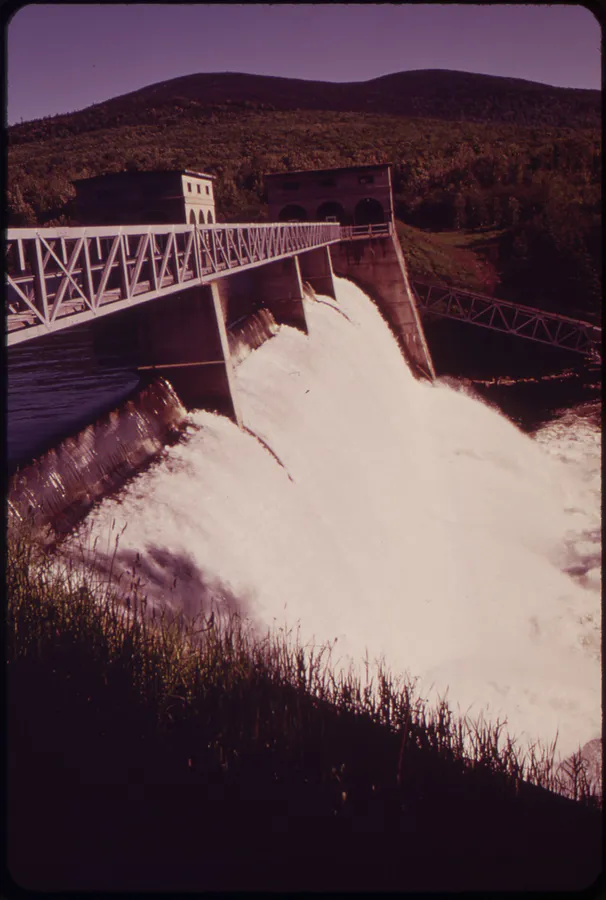
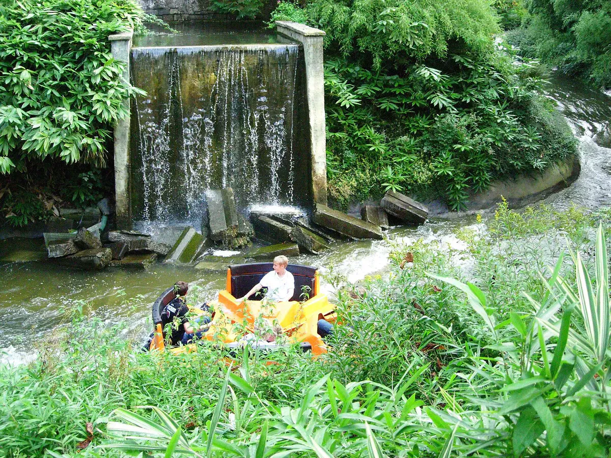
The whitewater section. The classic release run starts at the put-in just below Aziscohos Dam (about 44.9442, -70.9998). The first two miles are continuous and technical, up to Class IV at high release flows, and are strictly for experienced whitewater paddlers in proper gear. Below the steep section the rapids back off to Class I and II near Wilsons Mills.
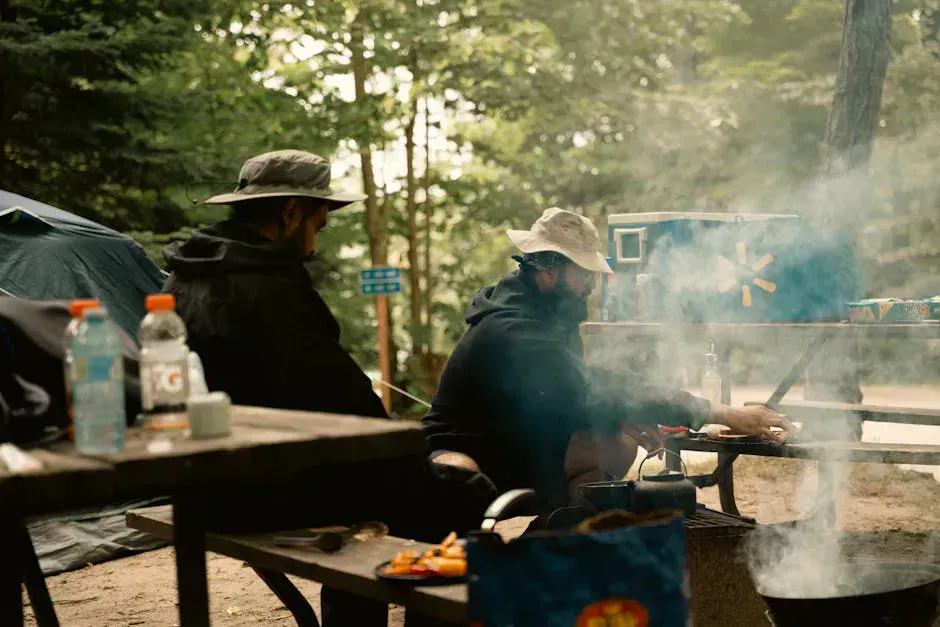
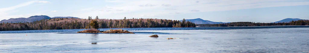
The flatwater and quickwater. From Wilsons Mills the river turns gentle, a mix of flatwater and easy quickwater that runs roughly 15 miles down to Umbagog Lake. This lower river is canoe country: slow current, big meanders, marshy banks, and constant wildlife. Paddlers often combine it with the lake for an overnight loop, camping at sites in the wildlife refuge.
Because the upper and lower sections demand such different skills, decide which river you are paddling before you go. The two do not mix well in a single boat.
The two miles below Aziscohos Dam are technical Class III-IV whitewater on release days, with cold water and fast, continuous rapids. This section is for experienced whitewater paddlers with helmets, drysuits or wetsuits, and self-rescue skills. Check the release schedule before you go, because the run is dewatered between releases. The lower flatwater is a separate, far easier paddle.
Access Points and Put-ins
The whitewater put-in is just below Aziscohos Dam off Route 16 near Wilsons Mills (about 44.9442, -70.9998). The Wilsons Mills access for the flatwater run is reached from Route 16, but some river access here crosses private property, so get permission or use established put-ins. From Errol, New Hampshire, the river is reached by driving north on NH-16/ME-16 about 15 miles. The lower river ends at Umbagog Lake, where refuge boat access and campsites are available.
Getting There
Wilsons Mills is in far western Oxford County, near the New Hampshire border. From Portland, take Route 26 north through Bethel toward Errol, New Hampshire, then ME-16 to Wilsons Mills, about three and a half hours. From the Rangeley area, follow Route 16 west to Aziscohos Lake and the dam. Fill your tank in Bethel or Rangeley, because services in this corner of the state are very limited.
The Aziscohos Dam put-in is off Route 16 just below the dam. Watch for the release-day crowd of whitewater boaters if you arrive on a scheduled flow day.
The whitewater only runs on scheduled summer releases, so call ahead or check the release schedule before driving all the way out here. Between releases the upper river is a boulder bed. If you want flatwater and wildlife instead, skip the dam and put in lower down for the quiet meanders toward Umbagog, where dawn paddles turn up moose in the shallows.
When to Visit
Spring
Natural high water can make the lower river fast and cold. Black flies are fierce in late spring. The dam-release whitewater follows the summer schedule.
Summer
Scheduled weekend dam releases bring the whitewater to life, and the lower river is warm and full of wildlife. Bug pressure eases by mid-summer.
Fall
Foliage and active moose during the rut on the lower river. Cold water, so dress accordingly. Some releases may continue early in the season.
Winter
The river is frozen and the access roads are not maintained for paddling. Not a season here.
Summer is the heart of the season: the dam releases run on weekends, the lower river is warm, and wildlife is everywhere. Fall brings foliage and rutting moose on the quiet lower stretches, with the trade-off of colder water and shorter days.
Packing List
Magalloway River Trip
- Whitewater kayak or canoe matched to your section
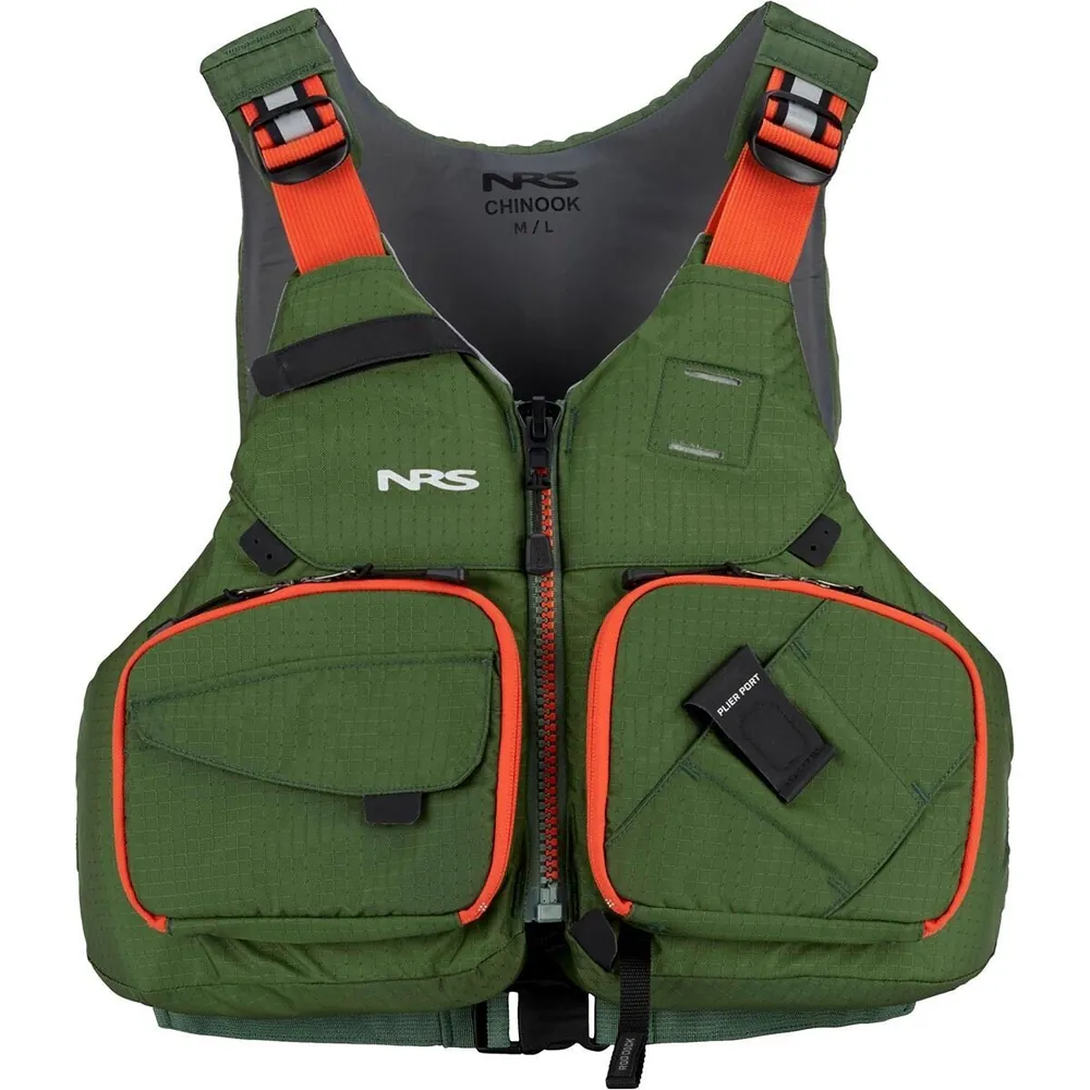
- Helmet for the dam-release whitewater
- PFD worn at all times
- Wetsuit or drysuit for cold water
- Dry bags for gear on overnight trips
- Bug spray and head net (late spring especially)
- Map and compass (no cell service)
- Binoculars for moose and eagles
- Release schedule checked before you go
FAQ
How hard is the Magalloway River?
It depends on the section. The two miles below Aziscohos Dam are technical Class III-IV whitewater on release days and are for experts only. Below Wilsons Mills the river is gentle flatwater and quickwater suitable for canoeists and wildlife watchers.
When can you run the whitewater?
The whitewater below Aziscohos Dam runs only on scheduled summer dam releases, typically weekends, with flows near 1,200 cubic feet per second. Between releases the upper river is dewatered, so check the schedule before you drive out.
How long is the river?
The Magalloway runs about 17.6 miles from below Aziscohos Dam down to Umbagog Lake. The upper two miles hold the hard rapids, and the lower 15-plus miles are flatwater and quickwater.
What wildlife will I see?
The lower river runs through the Umbagog National Wildlife Refuge, where moose, bald eagles, and waterfowl are common. Dawn paddles on the quiet meanders are the best time to spot moose feeding in the shallows.
Where do you put in?
Whitewater boaters put in just below Aziscohos Dam off Route 16 near Wilsons Mills. Flatwater paddlers use lower access points and often combine the river with Umbagog Lake. Some access crosses private land, so use established put-ins.