Ponds and Granite Ledges East of Bangor
Amherst Mountains Community Forest is a 4,974-acre Public Lands parcel in the town of Amherst, off Route 9 (“the Airline”) about 40 minutes east of Bangor in rural Hancock County. The state bought it in 2009 with Forest Legacy and Land for Maine’s Future funding, and it is managed in an unusual partnership: the Maine Bureau of Parks and Lands owns it, the town of Amherst helps run it, and the Forest Society of Maine lends a hand. The result is a quiet, well-cared-for tract of forest that sees a fraction of the traffic of the Downeast coast nearby.
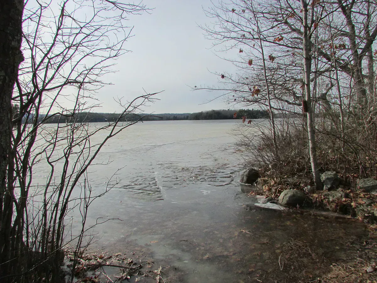
The land is a jumble of granite hills and ledges holding six ponds, miles of streams, and significant wetlands. Peregrine falcons and brook trout live here, and from the higher ledges you can pick out Cadillac Mountain and, on a clear day, Katahdin. About a half-dozen miles of hiking trail thread through it, with the standout being the climb up Bald Bluff Mountain.
The Trails
The signature hike is the Bald Bluff Trail, an easy-to-moderate, two-mile spur and loop. From the trailhead at the northwest corner of the forest off the 22-00-0 Road, follow the spur 0.3 miles, gaining about 180 feet, to the 1.7-mile loop. Two scenic viewpoints and a genuinely remote feel make it a rewarding short hike. For the full summit write-up, see our Bald Bluff Mountain guide.
The other main trails reach the backcountry ponds. The Ducktail Pond Trail runs a moderate 0.7 miles to Ducktail Pond and its campsite at the half-mile mark, then continues to connect with the Partridge Pond Trail and a pond overlook. Together they make a satisfying pond-to-pond loop on a quiet afternoon.
Camping and Fishing
Camping here is primitive and remote. There are pondside campsites, each with a fire ring, picnic table, and privy, available first-come, first-served. They sit at the ponds reached on foot, which keeps them secluded. The ponds hold brook trout, so a fishing rod and a Maine license earn their weight if you are packing in to camp. Kindle fires only in the authorized rings, do not cut live vegetation, and pack out everything you carry in.
Getting There
From the intersection of Route 9 and Route 181 in Amherst, drive west on Route 9 about 1.5 miles and turn right (north) onto the gravel Ducktail Pond Road (the 22-00-0 Road). The three trailheads are reached from this south entry, and the Bald Bluff trailhead can also be reached from the north off the 22-00-0 Road. For Bald Bluff, drive 5.9 miles on the gravel road to the parking area; the trailhead sign sits just south of the lot.
The road to the parking area is closed during spring mud season and is not plowed in winter, so plan trips for summer and fall when the gravel is firm. ATVs share the 22-00-0 Road, so stay alert for traffic, and remember there is no cell coverage out here once you leave Route 9.
When to Visit
Spring
The access road is closed during mud season, so early-spring trips may be off the table. Birders watch for returning migrants once it opens.
Summer
Firm gravel road, full trail access, pond camping, and brook trout fishing. The prime season.
Fall
Foliage from the ledges and the water, cool air, and few bugs. One of the best times to hike Bald Bluff.
Winter
The road is unplowed; snowmobilers pass through on the shared-use road. Not a casual-access season.
Summer and fall are the window. The mud-season road closure makes early spring unreliable.
Packing List
Amherst Community Forest Trip
- Sturdy hiking boots for ledge and root
- Daypack with water and snacks
- Tent and sleeping bag for pondside sites
- Maine fishing license for the trout ponds
- Bug spray for the wetlands
- Water filter for backcountry stays
- Paper map; there is no cell service
- Trash bags to pack everything out
FAQ
How long is the Bald Bluff Mountain hike?
It is a two-mile spur and loop, rated easy to moderate. A 0.3-mile spur with about 180 feet of gain reaches the 1.7-mile loop, which has two scenic viewpoints.
Can you camp in the Amherst Mountains Community Forest?
Yes. There are primitive pondside campsites, each with a fire ring, picnic table, and privy, available first-come, first-served with no fee. You hike in to reach them.
How do I get to the trailheads?
From the Route 9 and Route 181 junction in Amherst, head west on Route 9 about 1.5 miles, then turn north onto the gravel Ducktail Pond Road (22-00-0 Road). The road is closed during mud season.
What can I see from the ledges?
On clear days the higher viewpoints look out over the forested hills of Amherst and the lower Penobscot River valley, with Cadillac Mountain and even Katahdin visible.
Is there a fee?
No. Access and camping are free on this Public Lands parcel.
For the summit climb itself, see Bald Bluff Mountain, and for more Downeast hill country try the Donnell Pond public lands nearby.