The Bald Peak Beside Sugarloaf
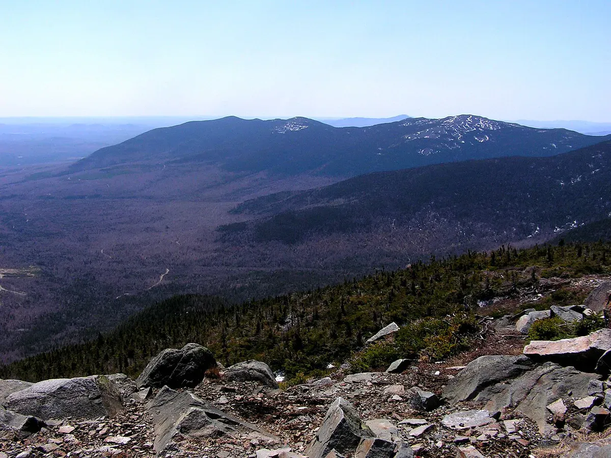
Burnt Mountain rises to 3,609 feet right next to Sugarloaf in Carrabassett Valley, and its summit is bare. The mountain burned in the early 1900s, and between the old fire and the strong winds that scour the top, the rocky summit stays inhospitable to large trees. The result is a treeless peak with a wide-open, 360-degree look across the western mountains, including a long, clean view of Sugarloaf itself rising next door.
It is a real climb, not a stroll. The round trip runs just under 6 miles with about 1,859 feet of elevation gain, and while it is not the longest day in the high peaks, the upper section is steep and the summit is fully exposed. For hikers who want a big alpine-feeling summit without the crowds on Sugarloaf, Burnt Mountain is one of the best-kept secrets in the valley.
The Trail
From the Sugarloaf base area the route follows roads and trail to the start of the climb, then works steadily up the mountain. The distance is about 2.9 miles one way for a round trip just shy of 6 miles. The grade is moderate at first and steepens through the middle, with two crossings of a mountain stream that can be slippery and, in high water, tricky. If the water is too high to cross safely, there is a narrow path along the east bank to work around it.
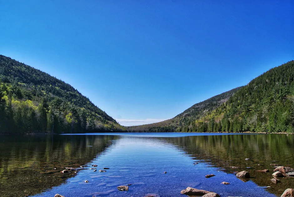
The trail keeps climbing through the trees until it breaks out onto the open, rocky upper mountain. The last stretch to the treeless summit is the steep, rewarding part, with the view widening at every step. From the top, Sugarloaf and the surrounding peaks of the Carrabassett Valley fill the horizon, and the alpine feel of the bare summit is the whole point of the hike.
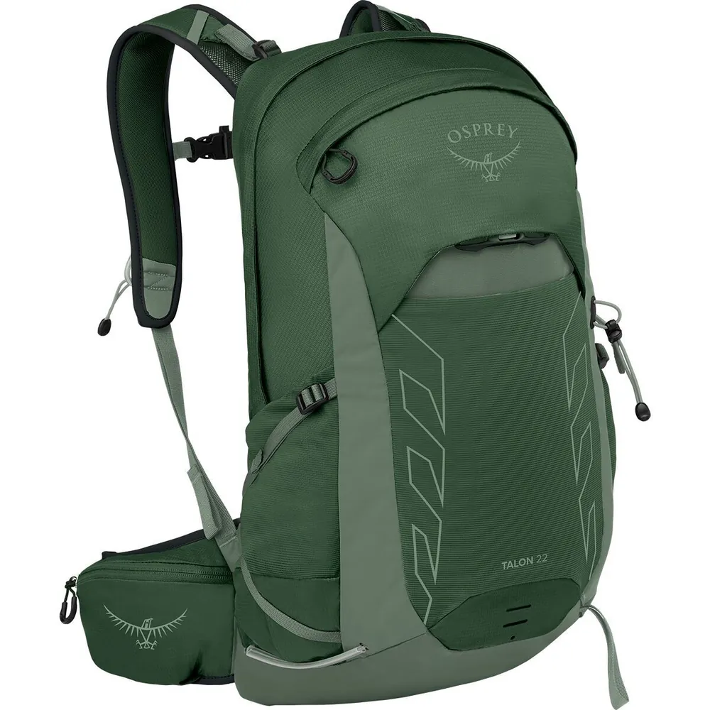
#1Mid-range
Osprey Talon 22
Who it’s forDay hikes & scrambles
Why we picked itExcellent ventilation with AirScape backpanel
Pros
- Body-hugging fit stays stable on scrambles
- Versatile 22L capacity hits the sweet spot
- Hipbelt pockets for snacks and phone
Know before you buy
- Not enough space for overnight gear
- Mesh back collects sweat in high humidity
There is an alternate descent through glades that some hikers use, but it is steep and unmarked, so the standard route up and back is the safer choice unless you know the mountain.
The Summit and the Views
Burnt Mountain’s summit is treeless and fully exposed to wind. There is no shelter at the top, the wind can be strong and cold even on a mild day, and weather moves fast in the high peaks. Carry a wind layer and a shell, check the forecast, and turn around if a storm looks likely, since there is nowhere to hide on the open summit.
Because the top is bare, the views are immediate and complete the moment you step out of the trees. Give yourself time up there, but keep an eye on the sky and on how cold the wind makes the summit feel.
Getting There
The hike starts from the Sugarloaf Mountain base area in Carrabassett Valley, off the Sugarloaf Access Road from Route 27. Park at the Base Lodge area, then walk past the lodge along Adams Mountain Road, continue past the condos to Mountainside Road, and cross to Bigelow Mountain Road. The Burnt Mountain trailhead is at the end of Bigelow Mountain Road.
Cell service in the valley is spotty and unreliable on the mountain. Download a map and check current trail conditions before you start, especially the stream crossings after heavy rain.
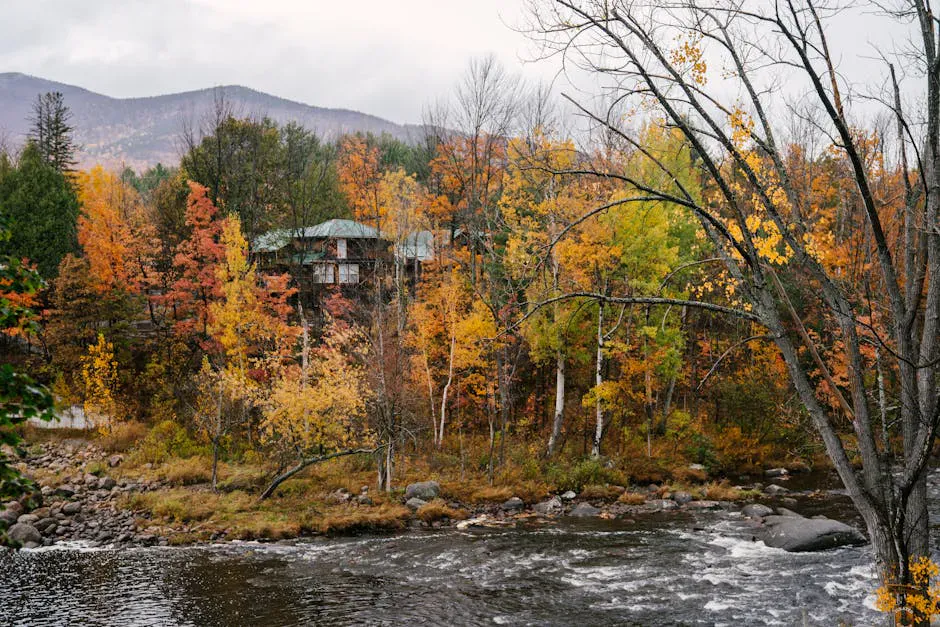
Use the Sugarloaf base as your staging point. There is plenty of parking, and walking out through the resort roads to the trailhead is part of the approach. Time your climb for a clear day, because the entire reason to hike Burnt Mountain is the open summit view, and there is nothing to see from the top in the clouds.
When to Visit
Spring
Snow lingers on the upper mountain into late spring, and the stream crossings run high with snowmelt. Black flies arrive mid-May.
Summer
The main hiking season. Long days and the most stable weather, with lower stream levels for safer crossings.
Fall
Cool, clear, bug-free, and full of foliage color across the Carrabassett Valley. The sharpest summit views of the year.
Winter
The exposed summit becomes a serious winter mountaineering objective, not a casual hike. Committing in snow and ice.
Late June through early October is the realistic window. September delivers cool air, firm footing, low water at the crossings, and the clearest views.
Packing List
Burnt Mountain Day Hike
- 2 to 3 liters of water
- Calorie-dense food for the summit
- Sturdy boots for the steep, rocky upper trail
- Trekking poles for the stream crossings and steep grade
- Wind layer and waterproof shell for the exposed top
- Hat and gloves; the summit wind is cold
- Offline map and a forecast check before you start
FAQ
How long is the Burnt Mountain hike?
Just under 6 miles round trip, about 2.9 miles each way, with roughly 1,859 feet of elevation gain. Plan on a solid half-day with time at the summit.
How hard is Burnt Mountain?
Hard. The upper section is steep, the summit is fully exposed, and there are two stream crossings that can be slippery or high after rain.
Where does the trail start?
At the Sugarloaf base area in Carrabassett Valley. From the Base Lodge, walk past the lodge and follow Adams Mountain Road to Mountainside Road, then cross to Bigelow Mountain Road, where the trailhead is at the road's end.
Are dogs allowed?
Yes, dogs are permitted. Keep them close on the exposed summit and be cautious at the stream crossings in high water.
What is the view like from the top?
The treeless summit gives a 360-degree view across the western mountains, with a long, clear look at Sugarloaf and the surrounding Carrabassett Valley peaks.
For the bigger neighbors, see Sugarloaf Mountain or the long ridge of Crocker Mountain.