One of Maine’s Last Wild Salmon Rivers
The Dennys River runs about 18 miles southeast from the outflow of Meddybemps Lake to the historic dam site in Dennysville, where it goes tidal and joins the Hardscrabble River to form Dennys Bay. It is one of only a handful of rivers in the country that still carries a run of wild Atlantic salmon, and historically it produced close to a fifth of the U.S. seaboard salmon run. That heritage shaped everything about the river today, from the conservation that protects it to the regulations that limit how it can be fished.
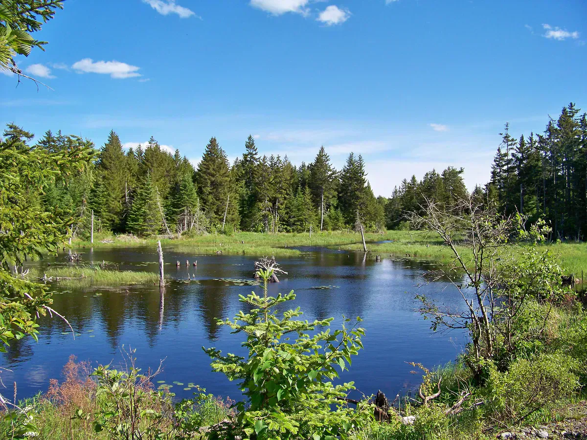
What makes the Dennys special for paddlers is how undeveloped it is. The Maine Atlantic Salmon Commission and partners including The Nature Conservancy and the Land for Maine’s Future program assembled more than 4,700 acres along the corridor, so much of the shoreline is forest and salt marsh rather than camps. The river winds through that conserved land quietly, with mostly gentle water that suits a canoe or a kayak. This is birding water as much as paddling water: the corridor holds the state’s highest concentration of nesting bald eagles, along with waterfowl and a rare freshwater mussel.
In 2020 the Downeast Salmon Federation removed an abandoned hydroelectric dam that had blocked fish passage near Meddybemps Lake, reopening spawning habitat for salmon and alewives. That work is one reason the river is paddled and watched as closely as it is.
Wildlife & bird watching
The Route
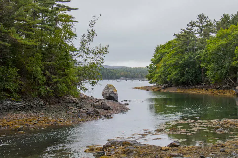
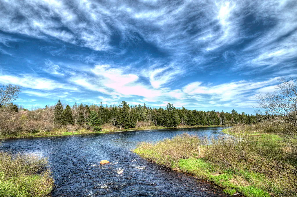
Most of the Dennys is calm, forested water that rewards an unhurried pace, winding through woods, salt marsh, and eventually estuary. The corridor from Meddybemps Lake down to Dennysville is the heart of it, and the conserved shoreline means you can paddle long stretches without passing a house.
It is not all flatwater, though. The river has a roughly 2.5-mile section rated Class I to III, so the trip is not uniformly easy and a paddler should know the water level and where the moving water is before committing. If you are new to river paddling or just want a relaxed birding day, focus on the gentler reaches and the tidal lower river near Dennysville rather than the whitewater section.
The Dennys has a 2.5-mile stretch of Class I to III water, and the lower river is tidal near Dennysville. Scout the moving sections, check the level before you launch, and time the tidal stretch so you are not fighting a strong current. When water is high, the rapids are more serious than the river’s gentle reputation suggests.
Access Points
Curry Landing is the main canoe access on the river corridor, reached via Eastern Ridge Road off Route 86. The upper put-in is at Meddybemps Lake, reached via Route 214 and Route 191 in the village of Meddybemps. The lower river runs down to Dennysville, where Route 1 crosses near the old dam site and the river turns tidal.
Because the river drops from the lake to tidewater, most trips run one direction and need a car shuttle between an upper and a lower access. Conservation lands along the corridor also offer riverside spots, including the Downeast Salmon Federation’s Dennys River Preserve with its picnic pavilion.
Getting There
Dennysville sits on Route 1 in Washington County, about two and a half hours from Bangor and roughly five hours from Portland. To reach the Meddybemps Lake end, follow Route 1 to Route 214 toward Meddybemps. Curry Landing is off Route 86 via Eastern Ridge Road between the lake and Dennysville.
Cell service is unreliable through this part of Washington County, so set your route and download maps before you leave Route 1.
When to Visit
Spring
High, cold water and active wildlife, including eagles on the nest. Blackflies are heavy from mid-May into June. The whitewater section is at its pushiest.
Summer
Settled water and warm air make the gentle reaches and tidal lower river ideal for a birding paddle. Bugs ease by late July.
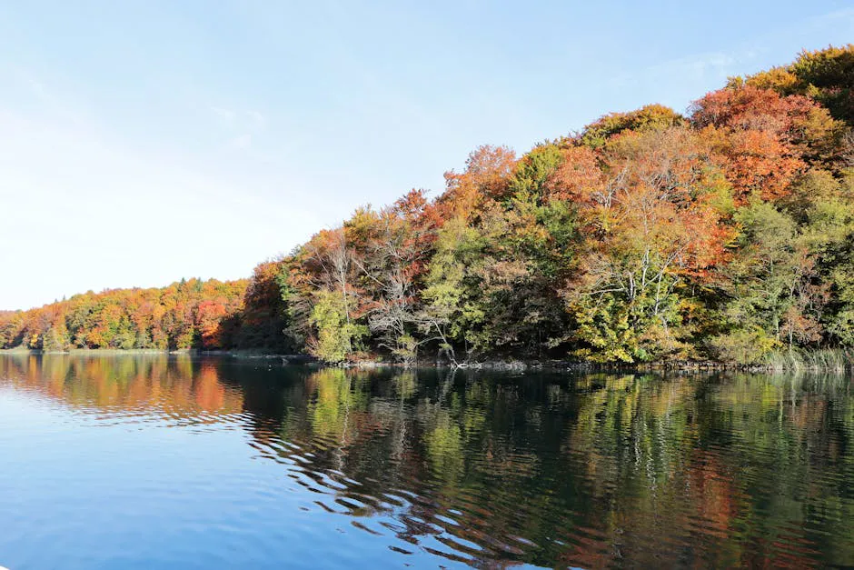
Fall
Cool, quiet, and bug-free with foliage along the corridor. Good waterfowl viewing.
Winter
The river freezes. Not a paddling season.
Summer is the most comfortable time to paddle the calm reaches and watch for eagles. Spring offers the highest water and the most active wildlife but the strongest rapids and the worst bugs. Fall is peaceful once the blackflies are gone.
Packing List
Dennys River Paddle
- Canoe or kayak with a PFD for each paddler
- Binoculars for eagles and waterfowl
- Dry bag for phone, keys, and camera
- Bug spray (essential May through early July)
- Sunscreen and a hat
- Tide chart if paddling the lower river near Dennysville
- Water and food
- Printed or downloaded map (cell service is unreliable)
FAQ
How long is the Dennys River?
The Dennys runs about 18 miles from the outflow of Meddybemps Lake to the old dam site in Dennysville, where it becomes tidal and joins Dennys Bay.
Where can I launch a canoe on the Dennys River?
Curry Landing, off Eastern Ridge Road from Route 86, is the main canoe access on the corridor. The upper end is reached from Meddybemps Lake via Route 214 and Route 191.
Is the Dennys River whitewater or flatwater?
Mostly calm, forested water, but it includes a roughly 2.5-mile section rated Class I to III. Scout the moving water and check the level before you go.
What wildlife will I see on the Dennys River?
The corridor holds Maine's highest concentration of nesting bald eagles, plus waterfowl and a rare freshwater mussel. It is also one of the last wild Atlantic salmon rivers in the country.
Do I need a shuttle?
Usually yes. The river drops from the lake down to tidewater, so most trips run one direction between an upper and lower access and need two vehicles.