A Hidden Gorge on Route 17
Cascade Stream Gorge is one of the best-kept secrets in western Maine’s waterfall circuit. Just off Route 17 in the small town of Byron, a narrow stream has carved a deep slot through layered metamorphic rock, creating a series of waterfalls, plunge pools, and water-carved formations packed into a gorge barely 10 feet wide in places. The individual falls are not enormous, but the density of cascades and the intimate scale of the gorge make this one of the most visually dramatic waterfall sites in the state.
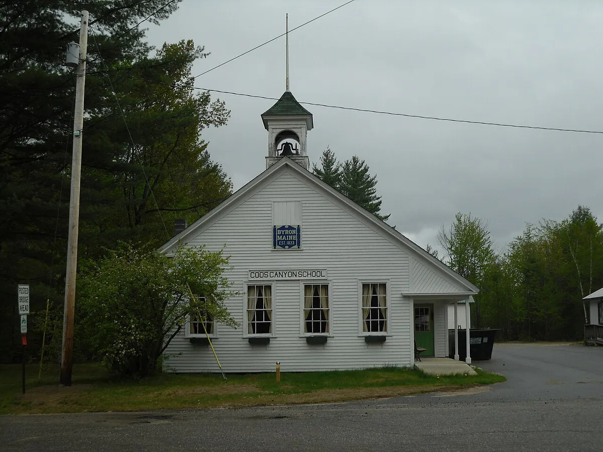
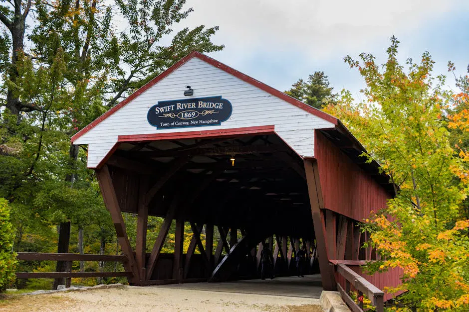
Route 17 between Rumford and Rangeley is one of Maine’s most scenic drives, climbing through the Swift River Valley and over Height of Land with its famous overlook of Mooselookmeguntic Lake. Cascade Stream Gorge sits along this route, roughly 12 miles north of the Coos Canyon swimming area and the gold-panning stretch of the Swift River. The trailhead is easy to miss if you are not looking for it: a small pulloff on the west side of Route 17 with no formal sign.
The gorge is the result of erosion through banded gneiss and schist, metamorphic rocks that were once sedimentary layers before being heated and compressed deep in the earth’s crust. The banding in the rock is visible on the gorge walls, with alternating layers of light and dark minerals creating striped patterns that frame the falling water. Mosses, ferns, and liverworts coat every surface that is not regularly scoured by floodwater.
Cascade Stream is a small waterway that responds quickly to rainfall. After a good rain, the gorge transforms from a trickle to a thundering series of cascades. The best visits are 12-24 hours after a significant rain event, when the flow is high but the water has cleared from its initial muddiness. In dry August, the stream can be disappointingly low.
Exploring the Gorge
From the roadside pulloff, a faint trail descends to the stream and follows the gorge upstream. The trail is unofficial and unmaintained, crossing the stream several times on rocks and fallen logs. Expect to get your feet wet, and lace up hiking boots with aggressive tread since the moss-slicked rock offers little grip. The gorge is roughly a quarter mile long, with cascades and pools appearing every 50 to 100 feet.
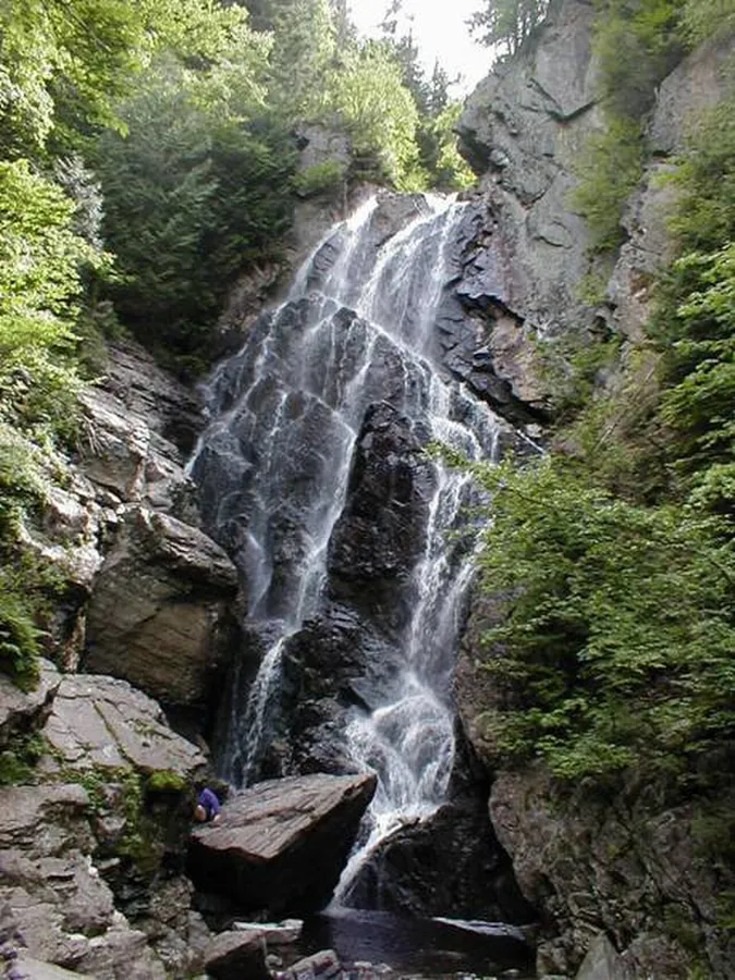
The first cascade you encounter is a six-foot drop into a dark plunge pool surrounded by moss-covered walls. Above it, the gorge narrows and the stream tumbles through a series of slides and chutes carved into the bedrock. The rock has been sculpted by centuries of water into smooth curves, potholes, and channels that are fascinating to examine up close.
The main cascade is roughly 12 to 15 feet high, a two-stage drop where the stream hits a ledge halfway down and fans out before collecting into the deepest pool in the gorge. Above the main cascade, several smaller falls continue up the ravine, each with its own character. The total vertical drop through the gorge is roughly 100 feet.
The narrowness of the gorge means light only reaches the bottom for a few hours around midday. Morning and late-afternoon visits put you in deep shade, which is atmospheric but challenging for photography. Midday light, when it penetrates to the pool at the base of the main cascade, creates dramatic contrast between the bright water and dark rock walls.
There is no maintained trail through Cascade Stream Gorge. You will scramble over wet rocks, cross the stream, and navigate steep, mossy slopes. Wear shoes with aggressive tread and expect to get wet. The gorge walls are steep and loose in places. Do not attempt to climb the vertical rock faces. This is not a boardwalk-and-railing experience.
Swimming
The plunge pools in Cascade Stream Gorge are small but deep enough for wading and brief soaking. The main pool below the largest cascade is roughly six to eight feet deep in the center and surrounded by smooth rock shelves. The water is cold, spring-fed, and refreshing on a hot day. The small scale of the pools means they fill quickly with even a few people.
The swimming is best in summer when air temperatures warm the rock around the pools. The gorge acts as a natural air conditioner, staying 10 to 15 degrees cooler than the surrounding forest, which is welcome in July but can be chilly in spring and fall. The cool, sheltered air also concentrates mosquitoes, so keep bug and tick protection within reach while you soak.
Combine Cascade Stream Gorge with a visit to Coos Canyon, about 12 miles south on Route 17. Coos Canyon offers swimming holes, gold panning, and a roadside gorge of its own. The two sites together make a full day of waterfall exploration in the Swift River Valley. Angel Falls, the tallest waterfall in Maine, is also within driving distance to the north.
When to Go
Spring
Highest water flow from snowmelt. Cascades are dramatic in May and June. Trail is muddy and stream crossings are deeper. Black flies.
Summer
Warm air, pleasant swimming. Flow depends on recent rainfall. Can be low in dry August. Midday light reaches the gorge floor.
Fall
Foliage contrasts with dark rock walls. Moderate flow. Cooler temperatures. Fewer visitors.
Winter
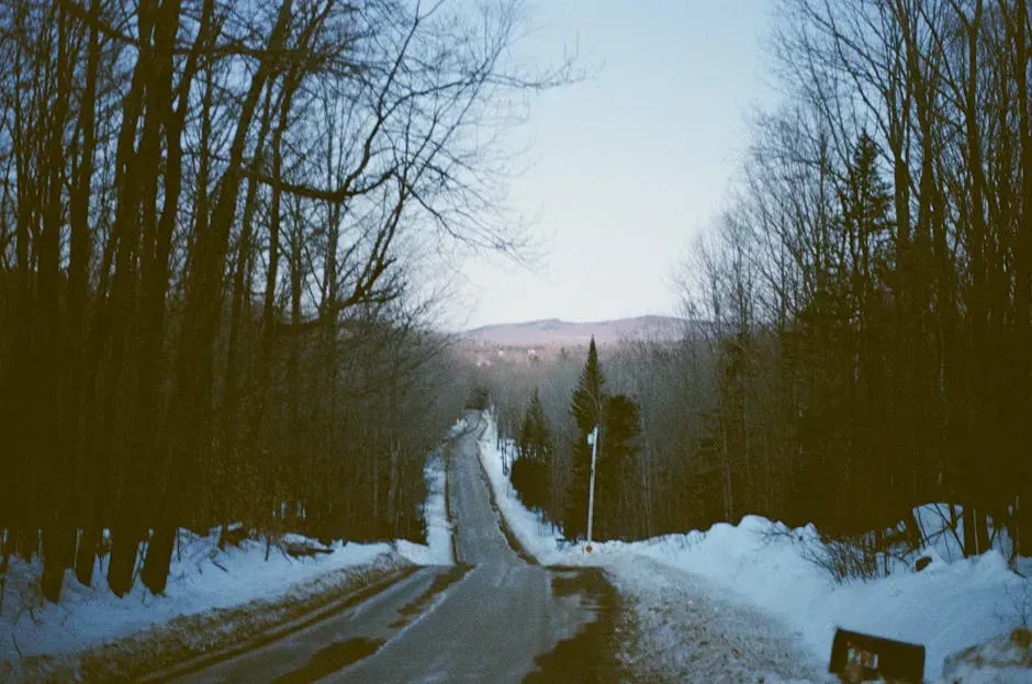
Ice formations in the gorge can be spectacular. Access via Route 17 is maintained but trail conditions are icy and dangerous.
Spring and early summer offer the best water flow. Summer is the most comfortable for swimming and exploring. Fall brings foliage color that reflects in the dark pools. Winter ice formations are dramatic but the gorge is dangerous when icy.
Packing List
Cascade Stream Gorge Visit
- Sturdy shoes with aggressive tread (wet rock scrambling required)
- Water shoes or sandals for stream crossings
- Camera (unique geology and lighting conditions)
- Swimsuit for the plunge pools
- Water bottle and snacks
- Bug spray (sheltered gorge holds mosquitoes)
- Rain jacket (weather changes quickly in the mountains)
- Headlamp or flashlight (deep gorge is dark in places)
Getting There
From Rumford, take Route 17 north toward Rangeley for approximately 18 miles. The pulloff for Cascade Stream Gorge is on the west (left) side of the road. There is no formal sign; look for a small gravel pulloff near where a stream crosses under the road. If you reach the Height of Land overlook, you have gone too far.
From Rangeley, take Route 17 south for about 12 miles. The pulloff is on the right side of the road.
From Portland, the drive is about 2 hours via Route 4 north through Farmington to Route 17 in Byron. From Bangor, expect about 3 hours via Route 2 west.
GPS coordinates for the trailhead pulloff: 44.7340, -70.6850
FAQ
Is there a marked trail to Cascade Stream Gorge?
No. There is no formal trail or signage. An informal path leads from the roadside pulloff to the gorge, but it is unmaintained. Expect to scramble over rocks and cross the stream. Wear appropriate footwear.
How tall are the waterfalls?
The individual cascades range from 3 to 15 feet. The main cascade is roughly 12-15 feet. The total drop through the quarter-mile gorge is about 100 feet across multiple falls and slides.
Can you swim in Cascade Stream Gorge?
Yes. Several plunge pools are deep enough for wading and soaking. The main pool below the largest cascade is 6-8 feet deep. The water is cold and spring-fed.
When is the best time to visit?
Late May through June for the highest water flow, or 12-24 hours after a significant rain event at any time during the season. Dry spells reduce the stream to a trickle.
Is Cascade Stream Gorge near other waterfalls?
Yes. Coos Canyon is about 12 miles south on Route 17, Swift River Falls is nearby, and Angel Falls (Maine's tallest waterfall) is accessible from the Rangeley area to the north. A full day of waterfall touring is easy from this area.