Maine’s Legendary Wilderness Canoe Route
The Allagash Wilderness Waterway is a 92-mile corridor of lakes, rivers, and streams running north through the heart of the Maine woods, from Telos Lake to the village of Allagash where the river meets the St. John. It was designated as the first state-administered component of the National Wild and Scenic Rivers System in 1970, and it remains one of the premier wilderness canoe routes in the eastern United States. Approximately 80 primitive campsites are scattered along the waterway, reachable only by paddling in.
This is not a weekend car-camping trip. A full traverse of the Allagash takes most paddlers seven to ten days, depending on pace and weather. You carry everything in your canoe, make camp on designated sites along the route, and navigate a landscape that has changed remarkably little since the Abenaki people and later the log drivers used these same waters. The forests are dense, the wildlife is abundant, and for long stretches the only sounds are your paddle, the current, and whatever the birds and wind are doing.
The waterway flows through some of the most remote territory in the eastern United States. The nearest paved roads are often 30 miles or more from the river. Cell service is nonexistent along virtually the entire route. This is wilderness camping in the truest sense, requiring self-sufficiency, preparation, and respect for the environment.
The Campsites
The approximately 80 designated campsites along the waterway are primitive by design. Each site typically has a fire ring, a picnic table, and a privy (outhouse). There are no showers, no electricity, no running water, and no camp stores. You filter, treat, or boil all your drinking water from the lakes and rivers.
Sites are spaced along the route to accommodate a reasonable daily paddling pace. Most are positioned on points, islands, or elevated banks with good water access for loading and unloading canoes. Some sites accommodate multiple groups; others are single-party sites with more privacy. During peak season (July and August), the most popular sites can fill, though the waterway rarely feels crowded given its length.
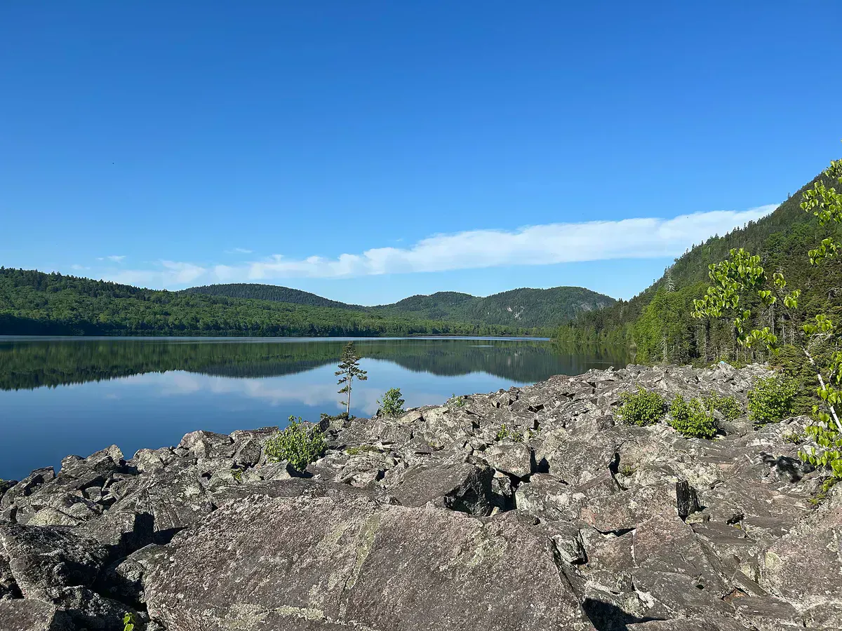
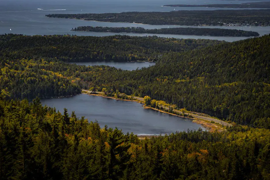
Site quality varies. Some are beautifully positioned on rocky points with sweeping lake views. Others are tucked into forest clearings along the river. The campsites on the lakes, particularly Chamberlain, Eagle, and Churchill, tend to be the most scenic. River sites offer the sound of moving water and closer proximity to good fishing.
Start early each morning and claim your next campsite by mid-afternoon. Sites are first-come, first-served, and while the waterway is large enough that you can usually find a spot, arriving late on a busy summer weekend could mean paddling further than planned. Rangers can advise on site availability at the registration stations.
Things to Do
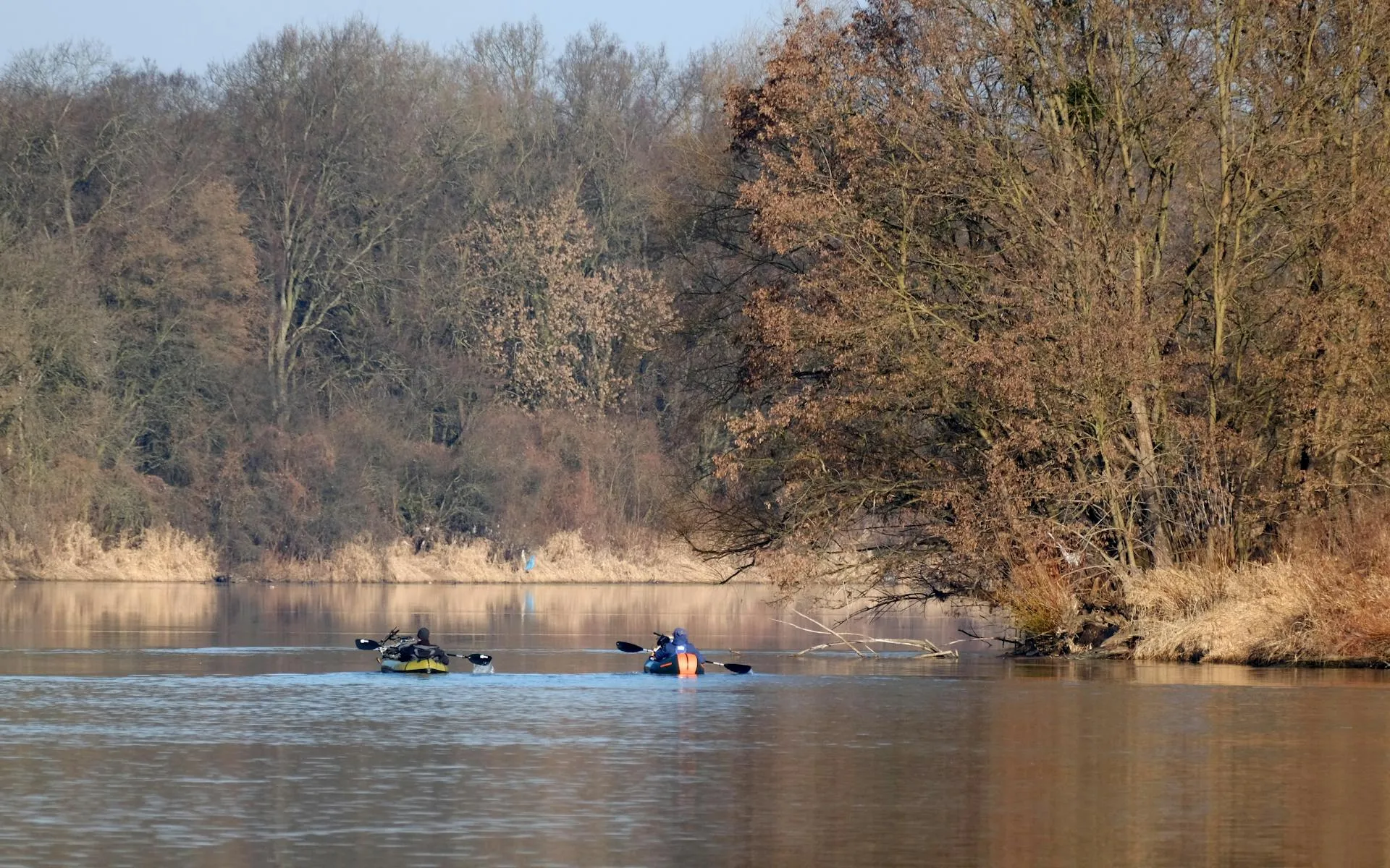
Paddling is the activity. The full 92-mile route begins at Chamberlain Bridge on Telos Lake and ends at the twin bridges on the Allagash River near the village of Allagash. The route crosses several large lakes, including Chamberlain, Eagle, and Churchill, connected by thoroughfares and streams. Below Churchill Dam, the river narrows and picks up current, with Class I and occasional Class II rapids adding variety to the flatwater paddling.
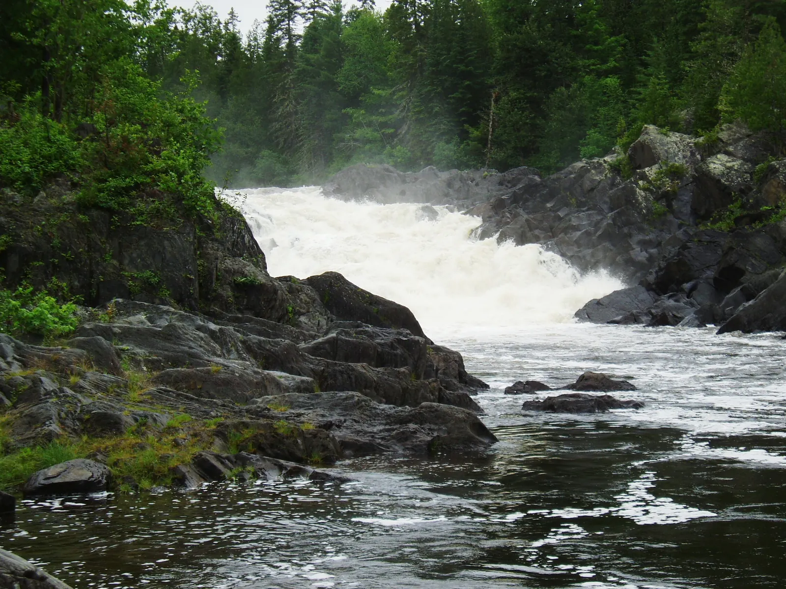
Allagash Falls, a dramatic 40-foot waterfall about 15 miles before the river’s end, requires a mandatory portage. The falls is one of the scenic highlights of the trip and a common lunch stop and photo opportunity.
Fishing is excellent throughout the waterway. Brook trout inhabit the streams and river sections, while lake trout and landlocked salmon are found in the larger lakes. The fishing is especially good in spring and early summer. A Maine fishing license is required.
Wildlife viewing is constant. Moose are common along the waterway, particularly in the boggy areas and at the edges of the lakes at dawn and dusk. Bald eagles nest along the route. Loons call across the lakes in the evening. Black bears are present but generally avoid people. Proper food storage is essential.
The Allagash is not a beginner canoe trip. You must be competent in canoe handling, including lake paddling in wind and basic whitewater skills for the river sections. Weather on the large lakes can change rapidly, with wind-driven waves that capsize canoes. Carry proper safety gear, know your limits, and be prepared for self-rescue. There is no cell service and evacuation from the interior is difficult and slow.
When to Go
Spring
High water makes for fast paddling, especially in May and early June. Water is cold, bugs emerge in late May, and weather is unpredictable.
Summer
Warmest water and air, longest days, most stable weather. July and August are peak season. Water levels drop on the river sections.
Fall
September brings spectacular foliage, cool nights, and no bugs. Water is low on the river. The waterway feels even more remote after Labor Day.
Winter
The waterway is frozen and not accessible for paddling. Some winter travel occurs on snowmobile, but camping infrastructure is not maintained.
Getting There
The Allagash Wilderness Waterway is accessed via a network of private logging roads. The most common put-in is at Chamberlain Bridge on Telos Lake, reached via the Golden Road from Millinocket or the Greenville Road from the west. The drive from Bangor to the put-in is approximately three and a half hours, mostly on gravel logging roads. From Portland, add another two and a half hours.
The take-out at the northern end is near the village of Allagash, accessible via Route 161. Most paddlers arrange a shuttle between the put-in and take-out. Several outfitters in Greenville and Millinocket offer shuttle services, canoe rentals, and guided trips.
You must register and pay fees at a ranger station at the entry point. Fees are $12 per person per night for Maine residents and $18 per person per night for non-residents. Rangers will review your itinerary and provide current information on water levels, campsite conditions, and any hazards.
If this is your first Allagash trip, consider hiring a registered guide for at least the first few days. A good guide knows the water, the campsites, and the portages. They can read the weather on the big lakes and keep you safe in the rapids below Churchill Dam. The Allagash is not a river that rewards overconfidence.
Camping Packing List
- Canoe or kayak (17-foot tandem canoe is standard)
- PFDs for every paddler (required by law)
- Paddles plus one spare per boat
- Dry bags for all gear and clothing
- Tent with full rain fly
- Sleeping bag rated to 30F
- Camp stove and fuel for the full trip
- Water filter or purification system
- 7-10 days of food in bear-proof containers or hang bags
- Detailed waterway map (DeLorme or equivalent)
- First aid kit with blister care and water treatment
- Bug spray, head nets, and long sleeves (June bugs are legendary)
FAQ
How long does a full Allagash trip take?
Most paddlers take 7 to 10 days to complete the 92-mile route. Fast, experienced paddlers can do it in 5 days, but that leaves little time for fishing, exploring, or resting on windbound days.
Do I need a permit?
You need to register and pay camping fees at a ranger station upon entry. Fees are $12/person/night for Maine residents and $18/person/night for non-residents. This is not a wilderness permit system with limited quotas.
Can I do a shorter trip?
Yes. Many paddlers do partial sections. The Chamberlain Lake to Churchill Dam section is popular as a shorter trip, as is the river section below Churchill Dam to the take-out. Outfitters can help plan a trip that fits your schedule.
Are the rapids dangerous?
The rapids below Churchill Dam are mostly Class I with some Class II sections. They are manageable for paddlers with basic whitewater experience but can be dangerous if you are unprepared. Portage options exist for the most difficult sections.
Is there any motorized access?
Motorboats are allowed on the large lakes (Chamberlain, Eagle, Churchill) with horsepower restrictions. The river sections are paddle-only. Floatplanes occasionally land on the lakes.