Maine’s Premier Wilderness Canoe Route
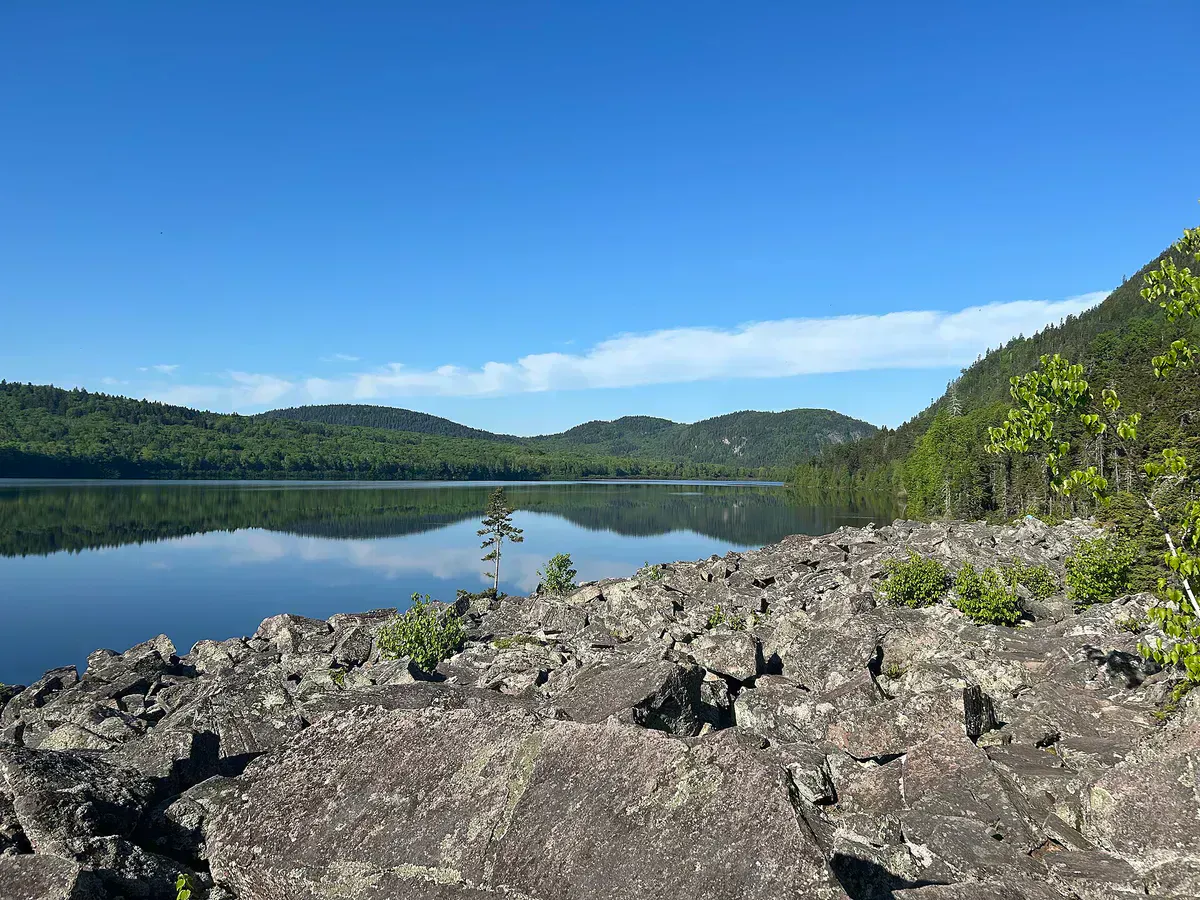
The Allagash Wilderness Waterway is a 92-mile corridor of lakes, ponds, rivers, and streams running through the heart of Maine’s North Woods. Designated as a National Wild and Scenic River in 1970 and managed by the state as a wilderness waterway, it remains one of the greatest multi-day canoe trips in the eastern United States. The route runs north from Telos Lake to the confluence with the St. John River near the Canadian border, passing through country that looks much the same as it did when Thoreau paddled here in the 1850s.
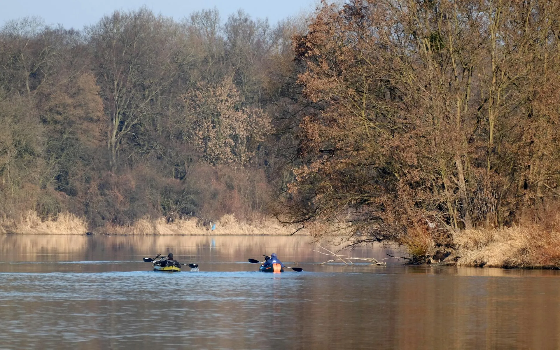
Most parties take seven to ten days to complete the full waterway, paddling through a chain of lakes in the upper section before entering the river proper for the downstream run. Moose sightings are nearly guaranteed. Loons call at dawn. Bald eagles fish the shallows. The night sky, free from any light pollution, is one of the darkest on the East Coast.
This is not a wilderness trip in name only. The Allagash corridor has no paved roads, no cell service, no stores, and no bailout points that do not involve a long paddle or a logging road drive. You need to be self-sufficient for the duration of your trip.
The Allagash Waterway is genuinely remote. There is no cell service anywhere on the route. The nearest hospital is hours away by logging road. You must carry all food, gear, and emergency supplies for the entire trip. Satellite communicators (InReach, SPOT) are strongly recommended. This is not a trip for unprepared paddlers.
Planning Your Trip
The classic full-length trip starts at Chamberlain Bridge on Chamberlain Lake and ends at the town of Allagash, 92 miles downstream. Most paddlers allow seven to ten days, which builds in layover days for fishing, exploring side streams, and waiting out weather. Faster parties can complete it in five days, but that leaves little time to enjoy what makes the trip special.
You can also paddle shorter sections. The lake section from Chamberlain Bridge to Churchill Dam covers about 30 miles and takes three to four days. The river section from Churchill Dam to Allagash is roughly 62 miles and takes four to six days. Each section has a distinct character.
The upper lakes (Chamberlain, Eagle, Churchill) involve open-water crossings that can get rough in wind. Whitecaps build quickly on these large lakes, and wind-bound days are common. The river section below Churchill Dam starts with a lively Class II rapid (Chase Rapids, 9 miles) before settling into a gentle current for the final run to Allagash.
If you want to skip the big lake crossings and focus on the river, put in at Umsaskis Lake. This cuts about 35 miles from the trip and avoids the most wind-prone sections. The river from Long Lake downstream through Round Pond and on to Allagash is consistently beautiful and more sheltered than the upper lakes.
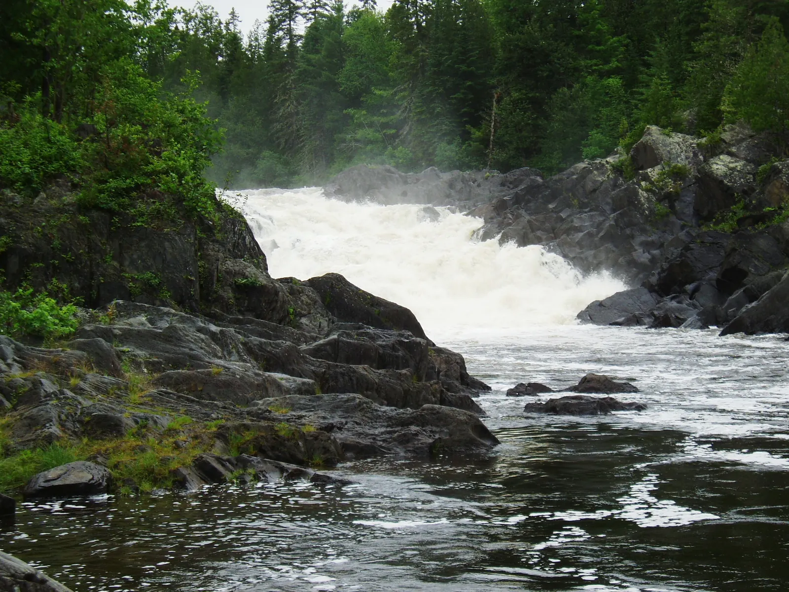
Chase Rapids
The most significant whitewater on the Allagash is Chase Rapids, a 9-mile stretch of continuous Class I-II water below Churchill Dam. The rapids begin immediately after the dam and run through a narrow, boulder-strewn channel. The water is fast and pushy but not technically demanding for competent paddlers. Canoes with a full load of camping gear should be paddled by people who are comfortable reading water and making quick turns, with solid paddling gear and dry bags lashed in.
A portage road runs along the north bank for the full length of Chase Rapids. Rangers at Churchill Dam can arrange a vehicle portage of your gear ($5 per canoe) so you can run the rapids in an empty or lightly loaded boat. This is a popular option and well worth the small fee.
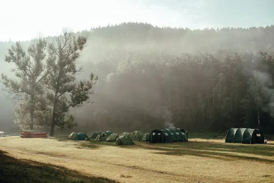
Camping on the Waterway
The Allagash Waterway has roughly 80 designated campsites spaced along the route. Sites are first-come, first-served and cannot be reserved in advance. Each site has a picnic table, fire ring, and privy. Most are set back from the water in the trees, and many have excellent views of the lake or river.
Rangers patrol the waterway and collect camping fees. Maine residents pay $6 per person per night; non-residents pay $11. Self-registration is available at put-in kiosks if you do not encounter a ranger.
Sites rarely fill up, even in July. The waterway sees only about 3,000 paddlers per year over the entire season. On most nights you will have your campsite, and possibly an entire lake, to yourself.
The campsite on the point at the north end of Eagle Lake has one of the best views on the entire waterway. You look south down the full length of the lake with mountains on both sides. It is exposed to wind, so choose it on calm evenings. The site at the outlet of Round Pond is another favorite, set in big pines with a sandy landing.
When to Go
Spring
High water, cold temperatures, intense blackflies in late May and June. Fast current makes river sections exciting but challenging.
Summer
Warm days, manageable bugs after mid-July, best for swimming. Water levels drop on upper lakes.
Fall
Spectacular foliage, cool nights, no bugs, very few other paddlers. Cold water and shorter days.
Winter
Waterway is frozen and inaccessible to paddlers.
Mid-July through August offers the most comfortable conditions: warm days, swimmable water, and diminishing bug pressure. June has higher water levels that make the river sections faster and more exciting, but the blackflies and mosquitoes can be brutal, so pack serious bug protection if you go early. September brings brilliant foliage and near-solitude, but nights are cold and the water is cooling fast.
Wildlife
The Allagash corridor is moose country. You will almost certainly see moose feeding in shallow coves, especially at dawn and dusk. The marshy areas around Round Pond and the river sections below Long Lake are particularly productive for sightings. Keep your distance. Moose are unpredictable and can be aggressive, especially cows with calves in June and bulls in rut in September.
Bald eagles nest along the waterway and are commonly seen fishing. Loons are present on every lake. Osprey, great blue herons, mergansers, and kingfishers are daily companions. Black bears inhabit the corridor but are rarely seen. Hang your food or use bear canisters.
Packing List
Allagash Wilderness Waterway Trip
- Canoe suitable for lake and river travel (17-18 ft recommended)
- PFD/life jacket for every paddler
- Dry bags for all gear (assume everything gets splashed)
- Tent with full rain fly and bug netting
- Sleeping bag rated to 30F (nights are cold even in summer)
- Camp stove and fuel for full trip (fire rings available but stove is reliable)
- Water filter or purification system
- Food for full trip plus two extra days
- Satellite communicator (InReach, SPOT), no cell service
- Bug spray and head net (essential May through mid-July)
- Detailed waterway map (DeLorme or AMC)
- First aid kit, repair kit, and duct tape
- Fishing rod and Maine fishing license
Getting There
Access to the southern put-in at Chamberlain Bridge requires driving logging roads through the North Maine Woods. From Millinocket, take the Golden Road west to Telos Road, then follow signs to Chamberlain Bridge. The drive is roughly 2.5 hours on gravel roads. A North Maine Woods access fee ($8/person/day for non-residents) is collected at checkpoints.
The northern take-out is at the town of Allagash on Route 161. Most paddlers arrange a shuttle in advance. Allagash Canoe Trips and several other outfitters provide full shuttle service from Allagash back to your vehicle at the put-in. Book early for July and August.
From Bangor, plan approximately 3.5 hours to reach Chamberlain Bridge. From Portland, the drive is about 6 hours.
GPS coordinates for Chamberlain Bridge: 46.2350, -69.2700
FAQ
How long does it take to paddle the Allagash Wilderness Waterway?
Most parties take 7 to 10 days for the full 92-mile route. Faster groups can do it in 5 days, but you miss the layover days that make the trip memorable. Shorter sections of 3-4 days are also popular.
Do I need a permit for the Allagash?
No advance permit is required. Self-register at the put-in kiosk. Camping fees are $6/night for Maine residents and $11/night for non-residents, collected by rangers or at self-registration stations.
Can beginners paddle the Allagash?
The Allagash is manageable for paddlers with basic canoe skills, but this is a remote multi-day wilderness trip. You must be self-sufficient and comfortable with open-water lake crossings. Chase Rapids requires moving-water competence. Most beginners should go with an experienced partner or guided trip.
Is there cell service on the Allagash?
No. There is no cell service anywhere on the Allagash Wilderness Waterway. Carry a satellite communicator for emergencies.
When is the best time to paddle the Allagash?
Mid-July through August for the best balance of warm weather, manageable bugs, and comfortable water temperatures. September is beautiful but cold. June has high water and intense blackflies.