The Headwater of the Allagash
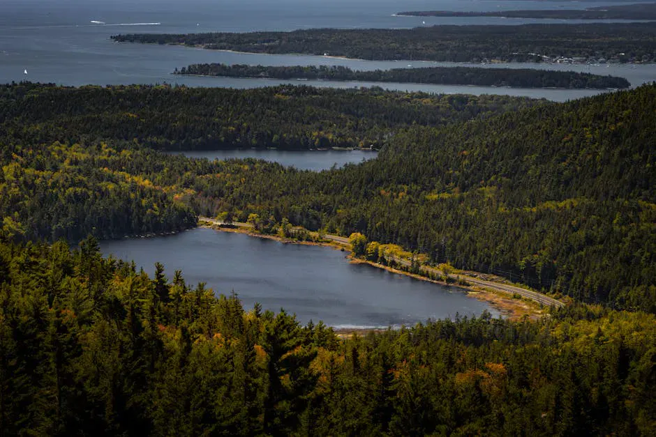
Chamberlain Lake is the largest lake in the Allagash River drainage and one of the biggest and deepest lakes in the North Maine Woods, spreading across nearly 11,000 acres at about 942 feet of elevation. It anchors the southern end of the Allagash Wilderness Waterway, the 92-mile ribbon of protected lakes and rivers that runs north toward the St. John. This is true wilderness water, surrounded by working forest and reachable only by long gravel logging roads, and it is the launching point for many trips down the Allagash.
The depth is remarkable: Chamberlain reaches about 154 feet, and its cold, clear water stays cold through summer, with temperatures dropping from the low 60s near the surface to the low 50s in the deep pools. That cold water is the engine of its fishery. Lake whitefish and round whitefish thrive here and feed the lake’s prized togue. For paddlers and anglers alike, Chamberlain offers big, remote, demanding water in one of the wildest corners of the Northeast.
Packable gear protection
Chamberlain Lake is large, cold, and far from help, with no cell service and the nearest towns hours away over gravel roads. Wind can build dangerous waves quickly on this much open water, and cold-water immersion is a serious risk even in summer. Carry a chart, a satellite communicator, layers, and a wind plan, and never paddle the open lake in a building breeze.
Paddling
For most visitors, Chamberlain Lake is the start of an Allagash Wilderness Waterway journey. From here, paddlers work north through the chain of lakes and the Allagash River toward the takeout near the Canadian border. The lake’s sheer size means it is a serious paddle in its own right, with long crossings exposed to wind and miles of wild, forested shoreline. Hugging the shore and timing crossings for calm mornings is the safe way to travel here.
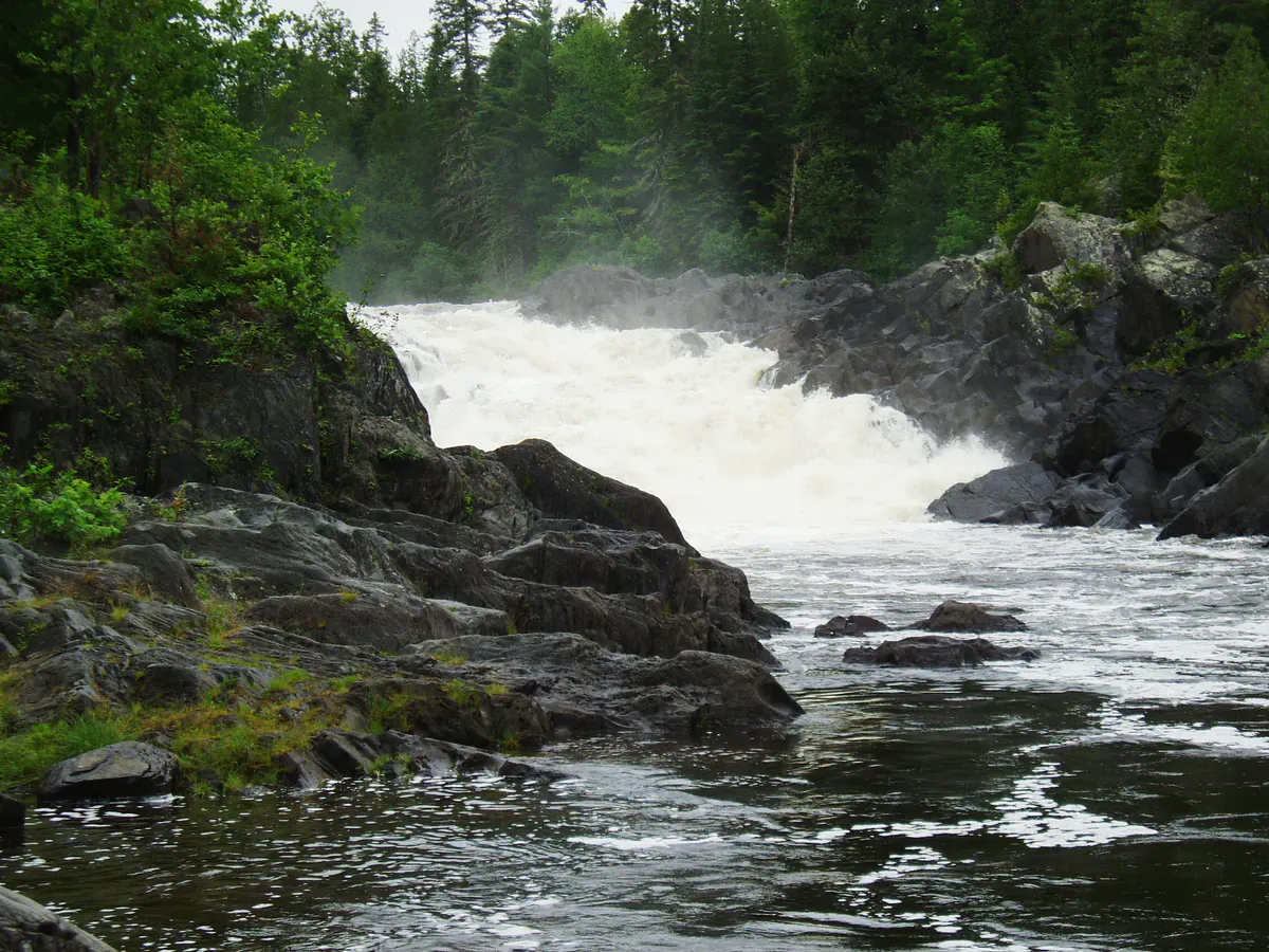
The northeast corner holds the Tramway Historic District, a must-see for anyone interested in Maine’s logging history, where a 3,000-foot mechanical tramway once hauled loaded boats and logs between Eagle and Chamberlain lakes. From the tramway you can portage to Eagle Lake and continue the classic Allagash route, or head to Lock Dam at the outlet for a shorter portage. These are the same waters generations of canoeists have traveled to reach the heart of the Allagash.
On a lake this big, wind is the real hazard. Make your long open-water crossings early in the morning before the breeze comes up, and be ready to wait on shore for hours, or a full day, if it is blowing. A canoe loaded for a multi-day Allagash trip is no match for the waves Chamberlain can build by afternoon.
Fishing
Chamberlain Lake is a renowned cold-water fishery, and togue, the Maine name for lake trout, are the main draw. The deep, cold, clear water is ideal lake-trout habitat, and the abundant whitefish forage grows them well. Anglers troll and jig the deep basins, going down to find the fish through the summer and reaching them shallower in spring and fall when the cold water rises.
Brook trout are also present and prized, found in the lake and in the cold tributaries and thoroughfares that connect the Allagash chain. This is wild, native-fish water managed carefully for its quality, so check the current Maine regulations for the Allagash region before you fish, and expect special rules designed to protect the togue and brook trout.
Access to Chamberlain is by long gravel logging roads through the North Maine Woods, with gate fees and registration at the checkpoints, plus Allagash Wilderness Waterway day-use and camping fees. Fuel up, supply fully, and register at the gates before you drive in. There are no services on the lake, only primitive campsites.
Getting There
Chamberlain Lake lies deep in the North Maine Woods in Piscataquis County, reached only by gravel logging roads through North Maine Woods gates. Most parties approach from the Millinocket or Greenville side via the private road networks, registering and paying gate fees at the checkpoints along the way. The final approach is rough, remote, and slow.
This is not a drive to attempt casually. Carry a current North Maine Woods map, a full tank of gas and a spare, food, and a satellite communicator, because there is no cell service and no quick way out. Many visitors arrive with a registered Allagash outfitter or guide, which is the simplest way to handle the logistics.
When to Visit
Spring
Ice-out comes late this far north and roads can be rough. Cold-water fishing is excellent but access is difficult and black flies fierce.
Summer
The main Allagash paddling and fishing season. Warmest weather and most reliable road access, though wind and bugs are constant factors.
Fall
Cool air, renewed cold-water fishing, and brilliant North Woods foliage. Fewer parties and crisp paddling, but plan for cold.
Winter
Deep wilderness winter with snowmobile access only. For experienced, fully self-sufficient parties.
Summer is the heart of the season for Allagash trips and Chamberlain fishing, with the most reliable access and warmest weather. Fall is quieter and beautiful but cold. Spring offers superb fishing for those who can manage the late ice-out and rough roads.
Packing List
Chamberlain Lake Trip
- Canoe or kayak rigged for wilderness travel
- PFDs and a dry bag for gear
- Maine fishing license and Allagash-region regulations
- Satellite communicator (no cell service)
- North Maine Woods map and chart of the lake
- Layers for cold-water immersion risk
- Bug spray (black flies and mosquitoes are intense)
- Full food, fuel, and water supply (no services)
FAQ
How big and deep is Chamberlain Lake?
Chamberlain Lake covers nearly 11,000 acres and reaches a maximum depth of about 154 feet at roughly 942 feet of elevation, making it one of the largest and deepest lakes in the North Maine Woods.
What fish are in Chamberlain Lake?
Chamberlain is a renowned cold-water fishery for togue (lake trout) and brook trout, supported by abundant lake whitefish and round whitefish forage in its deep, cold water.
What is the Chamberlain Lake Tramway?
In the northeast corner, the Tramway Historic District preserves a 3,000-foot mechanical tramway that once hauled boats and logs between Eagle and Chamberlain lakes. From there you can portage to Eagle Lake on the classic Allagash route.
How do you get to Chamberlain Lake?
Access is by long gravel logging roads through North Maine Woods gates, with registration and gate fees plus Allagash Wilderness Waterway day-use and camping fees. There is no cell service, so carry a map and satellite communicator.
Is Chamberlain Lake part of the Allagash?
Yes. Chamberlain Lake is the largest lake in the Allagash River drainage and the southern headwater of the Allagash Wilderness Waterway, with the historic Lock Dam at its outlet.