

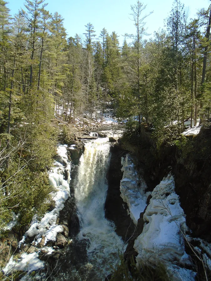
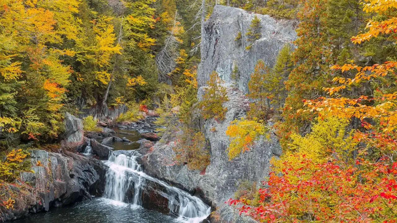
Maine has more named waterfalls than anyone has time to count, and they cluster. Drive to the right corner of the state and you can see six or eight falls in a day. Pick stops off a map and you can spend three hours between them.
Maine waterfalls by region
Start in the Western Mountains
- Most falls
- Western Mountains: Grafton Notch, Bethel, Rumford and Rangeley
- Tallest single drops
- Moxie Falls and Angel Falls, about 90 feet each
- Easiest stop
- Screw Auger Falls, a short path from the Grafton Notch lot
- Peak flow
- April to mid-May, when snow melts
This guide sorts 33 falls into the same regions the rest of this site uses. A few sit near region edges: Grand Falls, Moxie Falls and Houston Brook Falls are all in the upper Kennebec valley near The Forks and Bingham, and Tobey Falls is just south of Moosehead Lake. The Western Mountains and Grafton Notch hold most of them. Aroostook and the Katahdin region have a scattered handful in big woods country, the Moosehead region holds some of the tallest, and southern Maine has a couple worth a detour. Skip what doesn’t interest you and bookmark the regions you will visit.
Most of these falls mean scrambling over wet, mossy granite to get the good view, and the rock near the spray stays slick all day. Waterproof boots with real grip save you from a bad slip.
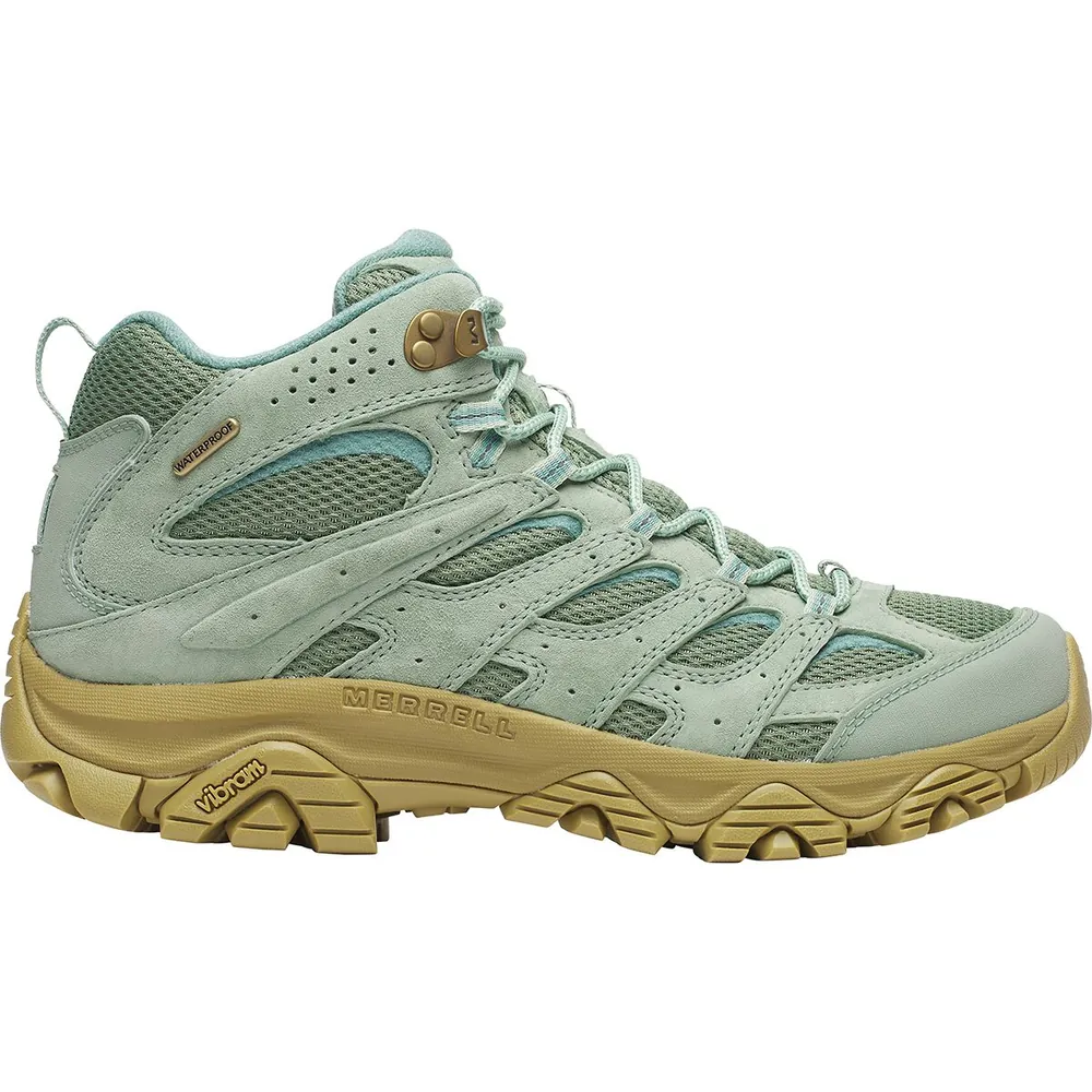
#1Premium
Merrell Moab 3 Mid Waterproof
Who it’s forComfort right out of the box
Why we picked itComfortable out of the box with minimal break-in
Pros
- Wide toe box fits most foot shapes
- Vibram TC5+ sole grips well on roots and mud
- Excellent value for the performance
Know before you buy
- Waterproof membrane wets out faster than Gore-Tex in sustained rain
- Ankle support is moderate compared to stiffer boots
Quick-Pick: 10 Must-See Maine Waterfalls
The ten falls most worth the drive. Trail distances are round trips.
| Waterfall | Region | Height | Trail | Swim? |
|---|---|---|---|---|
| Angel Falls | Western Mountains | 90 ft | 1.1 mi | No (shallow) |
| Moxie Falls | Moosehead | ~90 ft | 2 mi | No (view from the boardwalk) |
| Screw Auger (Grafton) | Western Mountains | 23 ft | Roadside | Wading only |
| Smalls Falls | Western Mountains | 54 ft (tiers) | Short walk | Lowest pool only |
| Gulf Hagas Falls | Moosehead | Multiple | 3.5-8 mi | Calm pools in low water only |
| Frenchman's Hole | Western Mountains | ~15 ft | 5 min walk | Yes |
| Coos Canyon | Western Mountains | Cascade | Roadside | Yes |
| Katahdin Stream Falls | Katahdin | 100+ ft (tiers) | 2.4 mi | No |
| Grand Falls ( Dead River ) | Near The Forks | 40 ft, 100+ ft wide | Under 1 mi | No |
| Rumford Falls | Western Mountains | 176 ft (tiers) | Roadside | No |
Western Mountains: The Waterfall Capital of Maine
The Western Mountains run from Grafton Notch through Bethel, Rumford and Rangeley up to Carrabassett Valley. Steep terrain and heavy rain carve the state’s best drops here, and 19 of the falls in this guide are in this region. If you have one weekend for Maine waterfalls, come here. Tap a pin for its photo and page.
Grafton Notch & Bethel Cluster
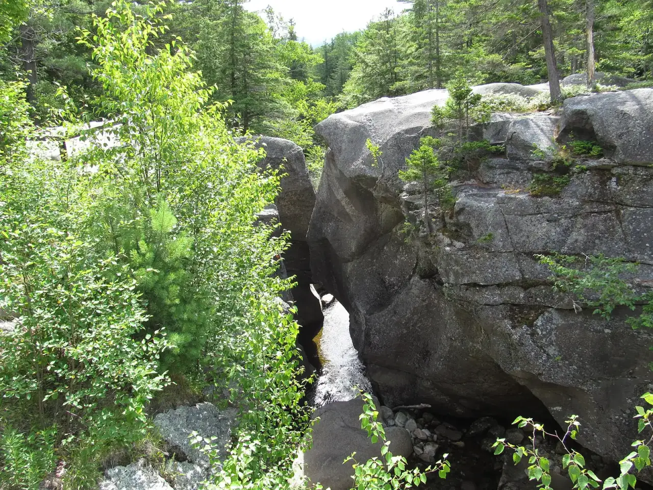
Grafton Notch State Park sits on Route 26 between Bethel and Upton, with two of Maine’s most photographed falls a few miles apart.
- Screw Auger Falls is the headline act. The 23-foot drop on the Bear River has carved deep potholes into the granite. The potholes are dangerous for swimming but great to look at.
- Mother Walker Falls is farther up Route 26: a narrow gorge about 40 feet deep with a boardwalk overlook. Fewer people stop, and it is worth the extra 10 minutes.
- Dunn Falls in Andover North Surplus is the hidden one: an 80-foot lower falls and a 70-foot upper falls on the West Branch of the Ellis River, on a 2.5-mile loop that uses the Appalachian Trail. The trail is rocky, and few tourists make the trip.
- Screw Auger Falls
- 23 feet, a short path from roadside parking
- Park day-use fee
- $3 Maine adult, $4 non-resident, $1 ages 5 to 11
- Frenchman's Hole
- About a 15-foot drop, a few minutes' walk
- Kees Falls
- Reached by the 2.1-mile Caribou Trail
- Mad River Falls
- 70 feet, 1.6 miles up the Royce Trail
- Swimming
- Frenchman's Hole only
Just south in Newry, off Sunday River Road, and farther south near Evans Notch:
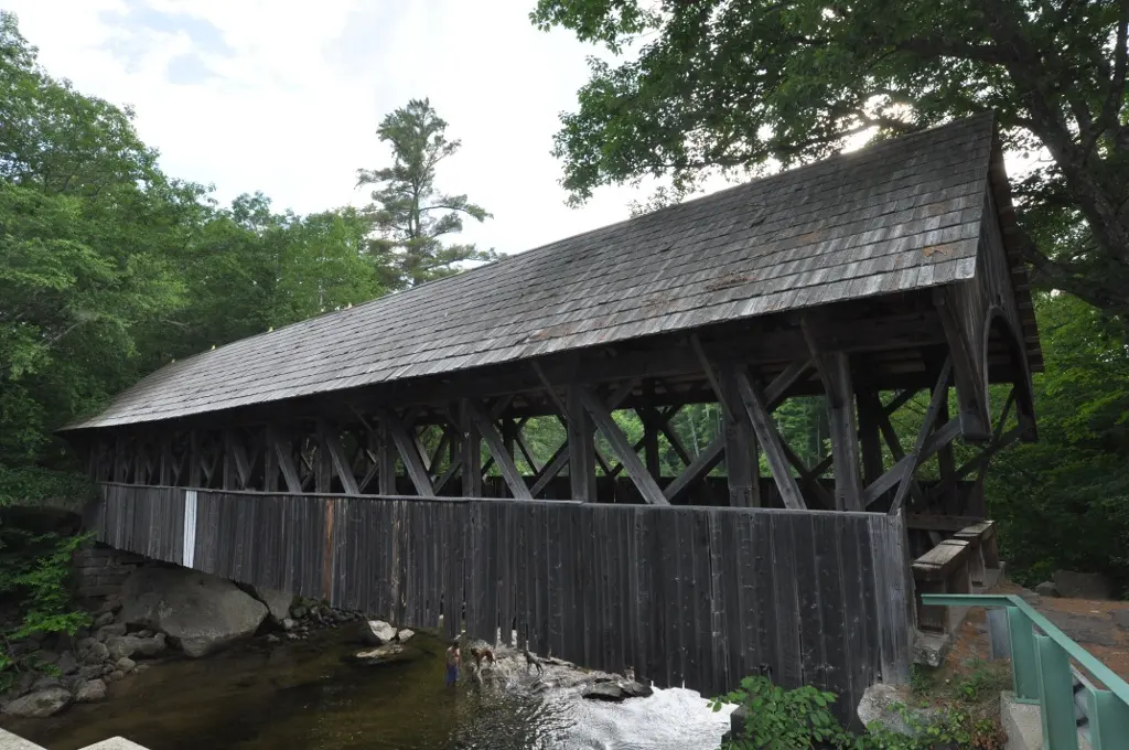
- Frenchman’s Hole is the most famous swimming waterfall in Maine: a drop of about 15 feet into a pool on state public land, a few minutes’ walk from the parking pull-off on Bull Branch Road. Depth changes with the water level, the ledges are slick, and there are no lifeguards, so don’t jump or dive. Come early on summer weekends.
- Kees Falls in Mason Township sits in the Caribou-Speckled Mountain Wilderness. Rugged and quiet, if you want to dodge crowds.
- Mad River Falls in Batchelders Grant is a 70-foot cascade in the Evans Notch area that rewards patience.
Bethel-area bonus: Ellis Falls in Andover is a 22-foot two-tier cascade with roadside parking, and Kezar Falls in Lovell is a 20-foot fall in a sculpted gorge near the New Hampshire border that most Maine visitors never see.
Rangeley & Rumford Cluster
Head north on Route 17 from Rumford and you are driving the waterfall alley of western Maine.
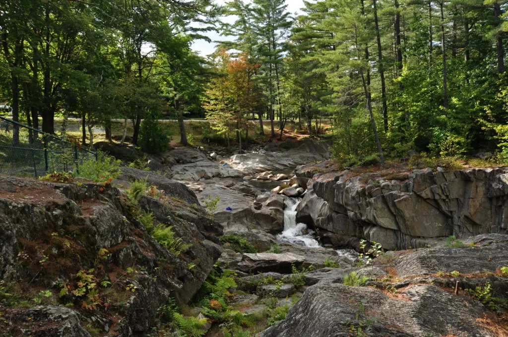
- Coos Canyon in Byron is a granite gorge on the Swift River, carved right alongside Route 17. Roadside access, pools for wading and swimming, and Maine’s most famous spot for amateur gold panning.
- Swift River Falls is a short drive upstream: cascades and swimming holes on the same river. The same granite-and-water setting, often with less company.
- Coos Canyon
- A 500-yard gorge beside Route 17
- Cost
- Free
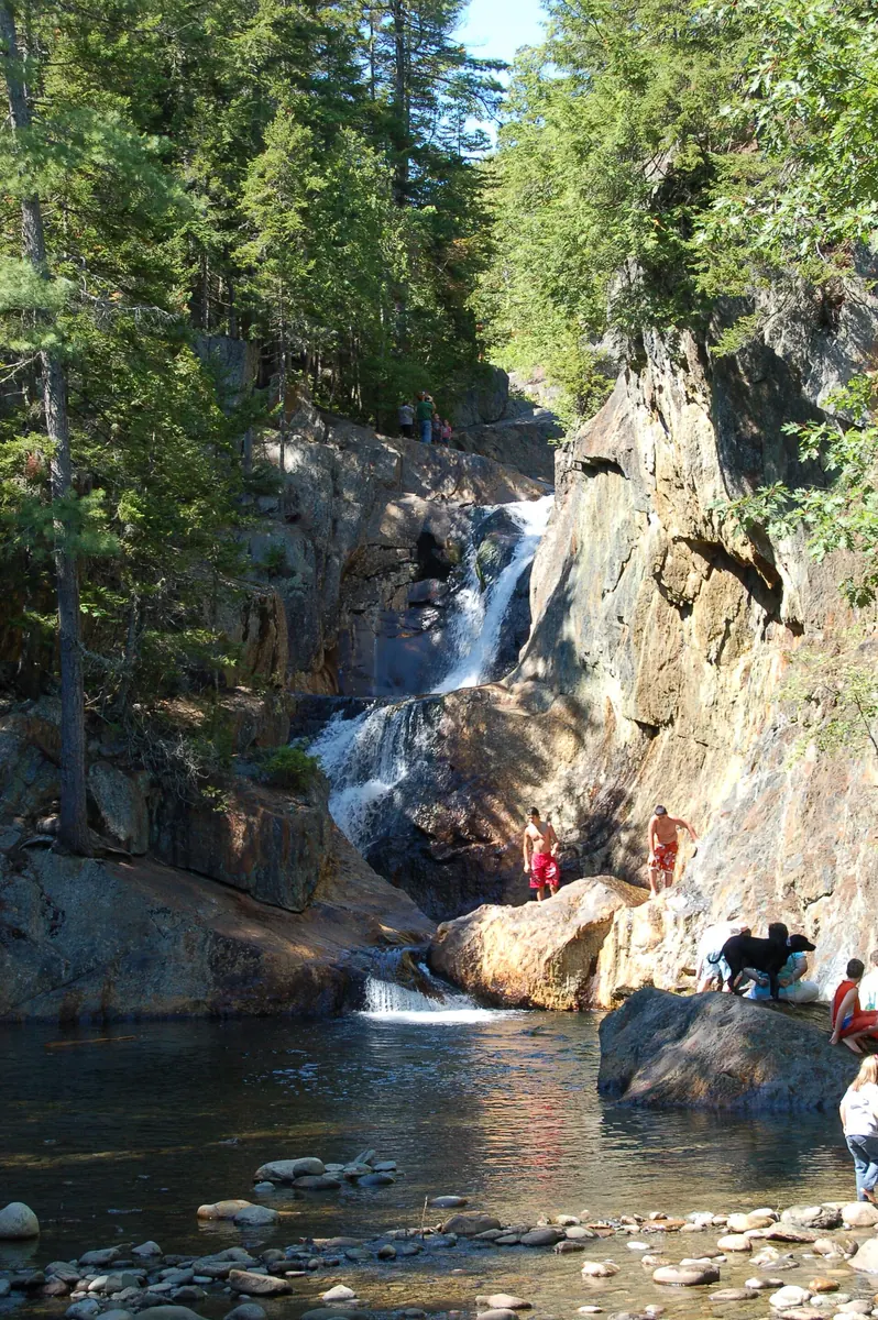
- Smalls Falls in Township E drops in tiers just off Route 4, about 12 miles south of Rangeley. Each tier has a pool, but only the lowest one, with a rocky beach, is the gentle spot to wade (New England Waterfalls); stay out of the pools above a drop, where a woman died in 2022. A rest area has picnic tables and a footbridge. Beloved and busy on summer weekends.
- Angel Falls in Township D drops 90 feet down a cliff face. The pool below is shallow, so it is not for swimming, but it is one of the most photographed falls in Maine. The short trail crosses Mountain Brook three times; skip it when the water is high. The gravel road in is rough, and high clearance helps.
- Smalls Falls
- 54 feet in tiers, a few hundred feet from parking
- Angel Falls
- 90 feet, 1.1 miles round trip
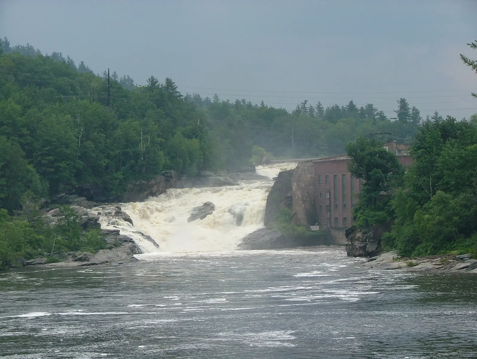
- Rumford Falls is an urban giant on the Androscoggin River, right in downtown Rumford. A dam controls the flow, so visit when water is running.
- Dingley Falls is a small cascade in a town park near downtown Rangeley, an easy stop for travelers who already have the famous falls covered.
- Bemis Falls in Township D is a cascade on Bemis Stream, south of Mooselookmeguntic Lake, that sees very few visitors. Check current trail status before you plan a hike in.
- Rumford Falls
- 176 feet over several tiers
- Where to watch
- Platforms at J. Eugene Boivin Park
Farmington & Carrabassett Valley
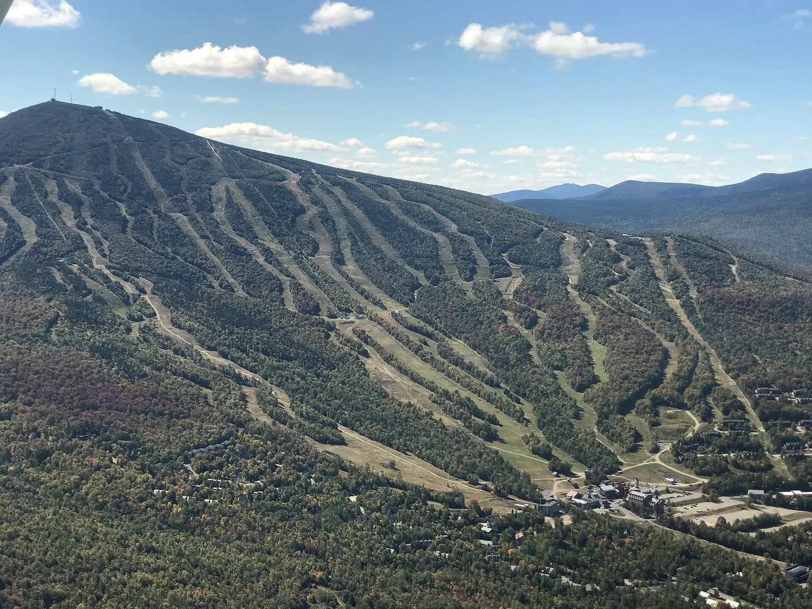
The northern stretch of the Western Mountains picks up on the way toward Sugarloaf.
- Mosher Hill Falls
- 45 feet, 0.3-mile trail
- Poplar Stream
- 24-foot upper falls, about 2 miles in
- South Brook
- 51-foot horsetail, a quarter mile farther
- Both falls
- About 4 miles round trip
- Mosher Hill Falls in Farmington is a short walk from the road: a 45-foot cascade over mossy ledges. Park at the roadside pulloff on Mosher Hill Road, which fits 3 or 4 cars. Enjoy it from the bank: the base sits in a narrow gorge and the mossy rocks stay slippery.
- Poplar Stream Falls in Carrabassett Valley is really two falls on the Maine Huts & Trails network near Sugarloaf: a 24-foot cascade on Poplar Stream and a taller horsetail on South Brook. The grade is gentle, and it is one of the best half-day waterfall hikes in Maine.
Southern Fringe: Snow Falls & the Saco River
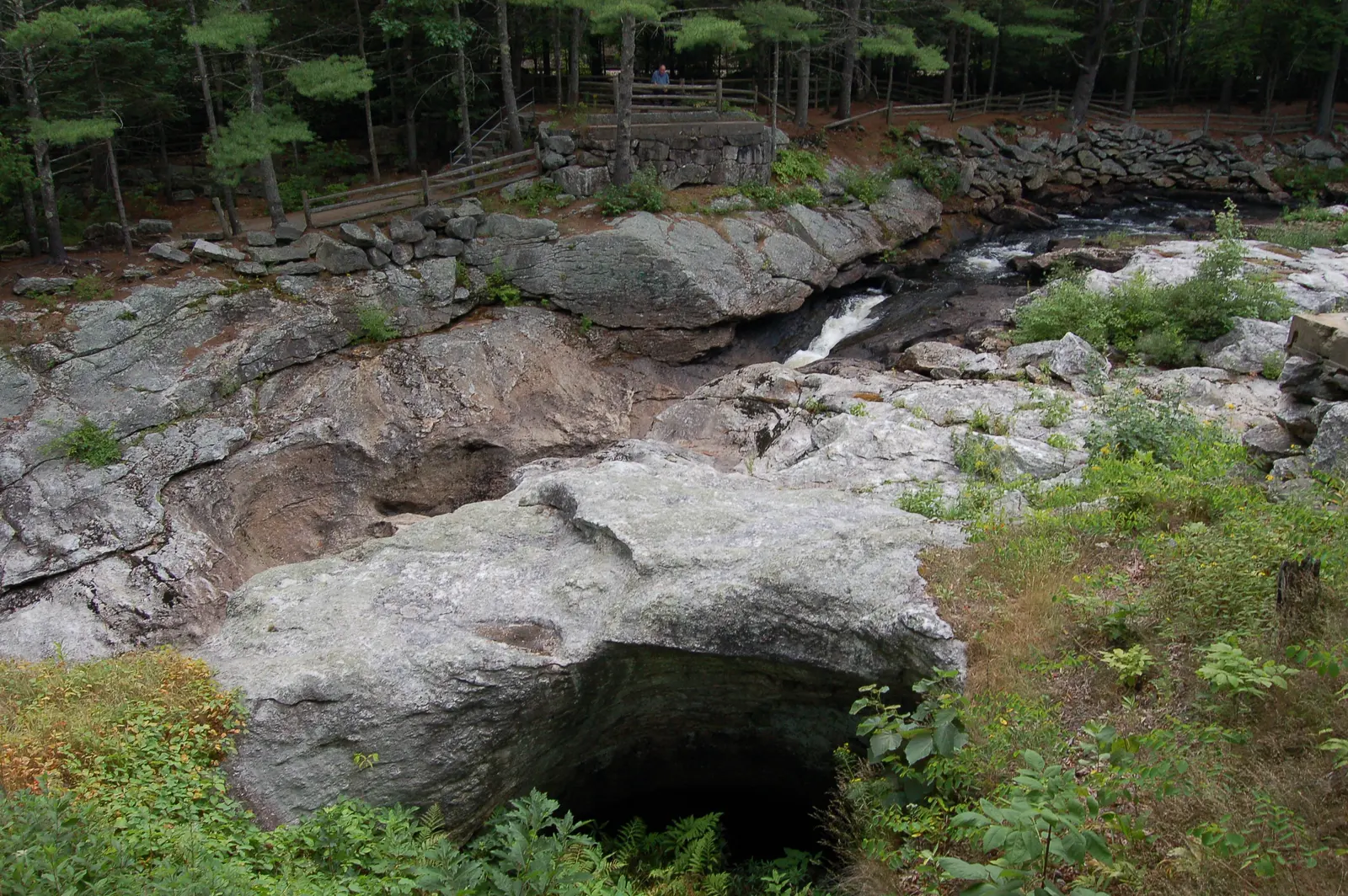
- Snow Falls in West Paris is roadside off Route 26, halfway between Portland and Bethel. A 25-foot cascade runs through a fenced gorge that you view from a bridge. It is a viewing stop, not a swimming hole, and an easy one if you are passing through.
- Rattlesnake Flume and Pool in Stow sits at the edge of the region, near Evans Notch. An easy trail leads to a narrow granite flume and one of the most calendar-perfect gorge pools in Maine.
Cascade Falls (Saco) is in southern Maine proper, in the city of Saco rather than the western hills. It is covered with the Greater Portland falls below.
- Snow Falls
- 25 feet, seen from a bridge and rest area
- Rattlesnake Pool
- An easy hike of about 2 miles round trip
The western mountains have dozens of small unnamed cascades on feeder streams between the famous falls. If you see a pull-off on Routes 17, 26, or 4 next to a mountain stream, walk 100 feet into the woods. You will often find a surprise.
Aroostook & Katahdin: Deep-Woods Waterfalls
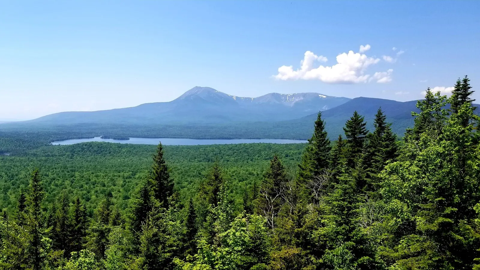
Northern Maine has fewer waterfalls than the western mountains, but the ones up here feel remote. You will not be sharing them with tour buses. Grand Falls, listed here, sits far to the southwest near The Forks.
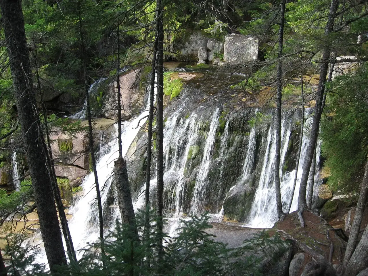
Katahdin Stream Falls in Baxter State Park tumbles down a series of ledges beside the Hunt Trail. It is the easy waterfall you pass on the way up Katahdin, but it is a good destination on its own: a moderate forest walk of about 2.4 miles round trip, fine for hikers with no plan to climb the mountain. The rocks around the falls are slippery, so watch from the trail’s viewpoints.
- Distance
- About 1.2 miles each way on the Hunt Trail
- Height
- Over 100 feet in several tiers
- Shin Falls
- 44 feet in three drops
- Buttermilk Falls
- 30 feet on Cochrane Brook
- Otter Falls
- 15 feet, deep in the woods
- Tobey Falls
- An 8-foot slide by the road
- Shin Falls in Mount Chase is a short hike to a three-step drop on Shin Brook. Scenic, quiet and often skipped by visitors focused on Baxter.
- Sawtelle Falls in T6 R7 WELS, near Shin Pond, is a half-mile hike off Scraggly Lake Road. Go for the isolation more than the spectacle.
- Otter Falls in T4 R11 WELS, near the Debsconeag Lakes Wilderness, is the sort of place you find when you are already in the big woods.
- Buttermilk Falls in Ludlow Township is a small Aroostook falls (not the Buttermilk Falls at Gulf Hagas, in the Moosehead section below).
- Tobey Falls in Willimantic, south of Moosehead Lake, slides over a ledge on Big Wilson Stream. An easy side trip on a Moosehead visit.
Grand Falls on the Dead River in Lower Enchanted Township is one of the biggest waterfalls in Maine by volume: a 40-foot horseshoe more than 100 feet across. Most visitors drive the 14-mile dirt Lower Enchanted Road off Route 201 to the rafting launch, then walk under a mile round trip. Others see it from a raft on the Dead River. Real adventure territory.
Moosehead Region: Tall Drops & The Gulf
The Moosehead region has fewer falls but holds some of Maine’s tallest and most dramatic.
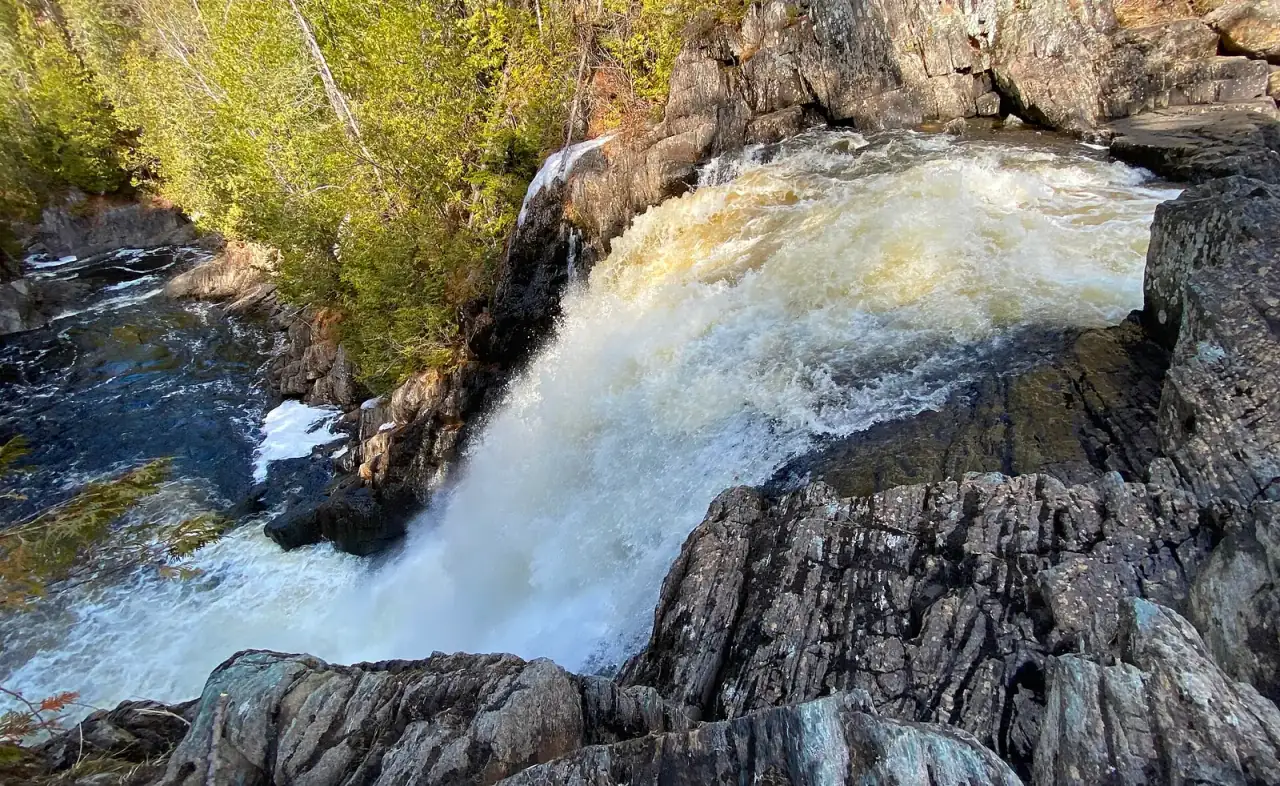
- Moxie Falls in Moxie Gore, near The Forks, is one of the tallest in New England at about 90 feet. A mostly flat trail, about a mile each way, ends at a boardwalk and viewing platforms above the gorge. The gorge walls are steep and the rock is slippery, so stay on the boardwalk and the viewing platforms.
- Moxie Stream Falls is a smaller, quieter cascade downstream on the same stream. Pair it with Moxie Falls the same afternoon.
- Moxie Falls
- About 90 feet, 2 miles round trip
- Swimming
- Not recommended; stay on the boardwalk
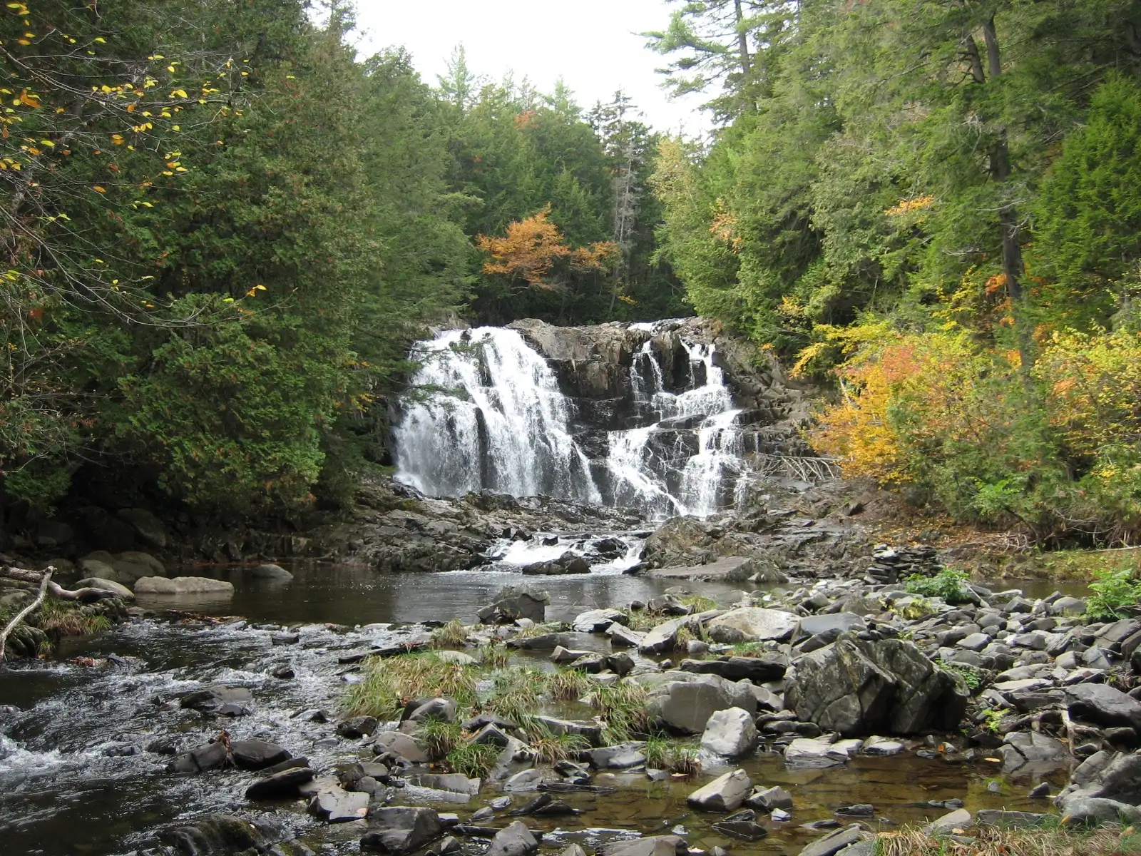
- Houston Brook Falls in Pleasant Ridge Plantation is a broad 40-foot fall. Stay out from under the falling water; a shallow channel a little way downstream is better for wading than swimming, and its depth changes with the flow (New England Waterfalls). It is an easy walk through cedar forest. It feels like a locals’ spot even on busy weekends.
- Hay Brook Falls in T7 R9 NWP is a 25-foot plunge in the 100-Mile Wilderness, a short walk off the trail to Gulf Hagas. Getting there means gravel roads and a gate, so you will usually have it to yourself.
- Houston Brook Falls
- 40 feet, a quarter-mile walk
- Hay Brook Falls
- 25 feet, KI Jo-Mary gate fee
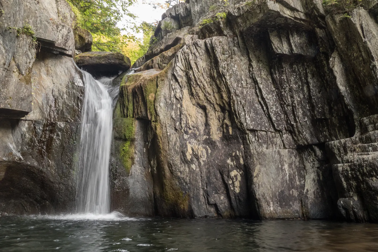
Gulf Hagas Falls is the headline act: a 3-mile slate canyon on the West Branch of the Pleasant River. People call it the “Grand Canyon of Maine,” which overstates things but captures the idea. A string of falls lines the rim trail: Screw Auger Falls (pictured), Billings Falls, The Jaws, Stair Falls, Buttermilk Falls and Head of the Gulf. An out-and-back to Screw Auger alone is about 3.5 miles. You pay at the KI Jo-Mary checkpoint and ford the river, which is unsafe in spring runoff.
- Full loop
- About 8 miles, 5 to 7 hours
- Day-use fee
- $13 Maine resident, $18 non-resident, cash or check
Southern Maine & Greater Portland
Southern Maine is mostly coastline, not mountains, so waterfalls are scarce. Two are worth knowing.
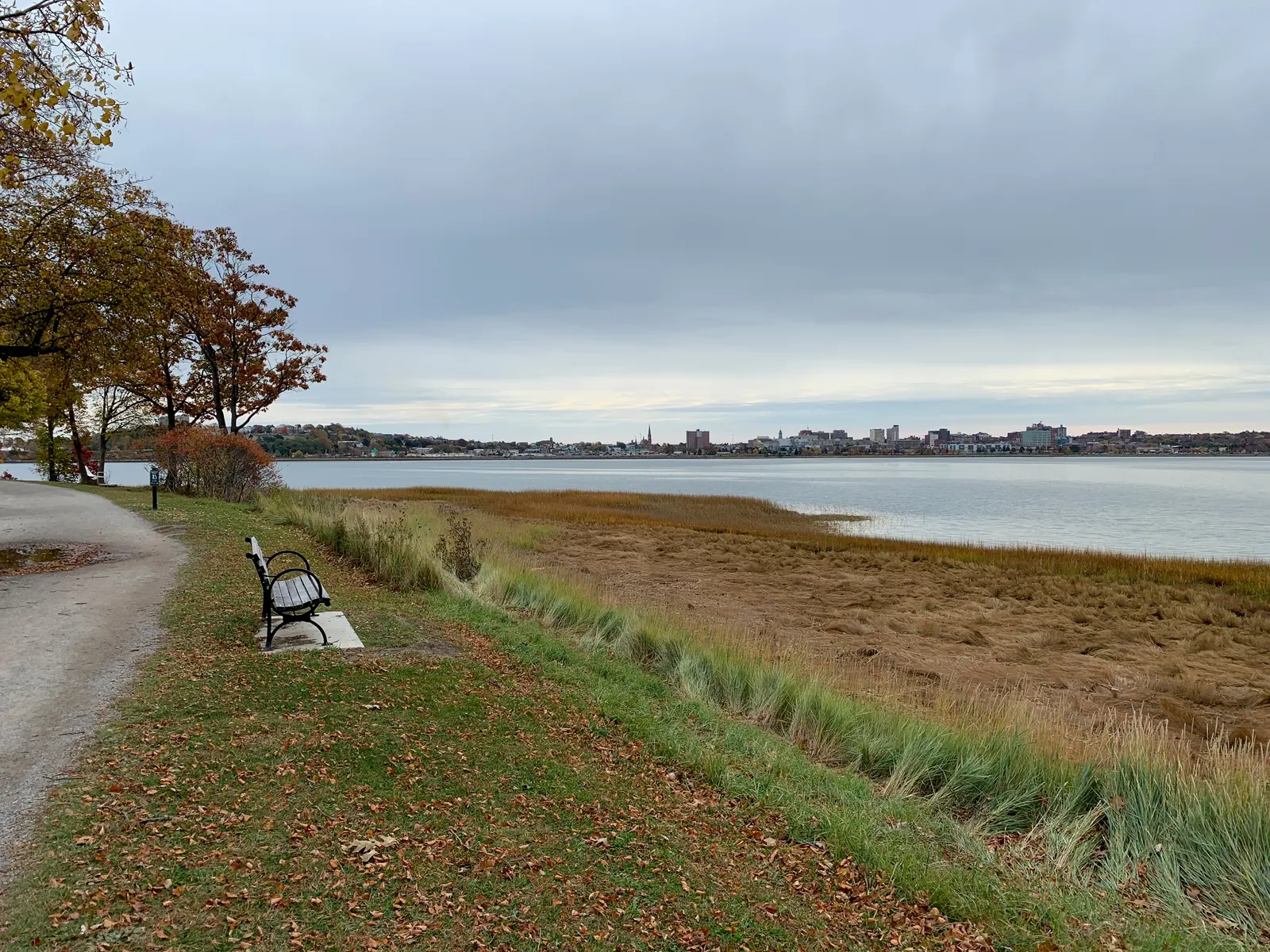
- Jewel Falls
- 25 feet, about a five-minute walk
- Cascade Falls
- 20 feet, short trails
- Jewel Falls is Portland’s only natural waterfall, a 25-foot cascade in the 85-acre Fore River Sanctuary. Park at the end of Hillcrest Avenue (Rowe Avenue has two accessible spaces) and the falls are a few hundred feet down the trail. For Portlanders who want woods and water without driving an hour, it is the option that exists.
- Cascade Falls (Saco) is a 20-foot horsetail on Cascade Brook, a quarter mile up Cascade Road from Route 1, with short trails kept up by volunteers (Maine Trail Finder). Easily missed, and a pleasant lunch-break stop near Old Orchard Beach or Saco.
Downeast and coastal Maine have a few small drops not covered in this guide, but if waterfalls are your main goal, head inland.
Maine Waterfalls by Experience
Same falls, sorted by what you want to do.
Best Roadside (No Hiking)
From the parking lot or within about 5 minutes on foot:
- Screw Auger Falls, Grafton Notch
- Coos Canyon, Byron
- Snow Falls, West Paris
- Ellis Falls, Andover
- Rumford Falls, Rumford
Best Swimming
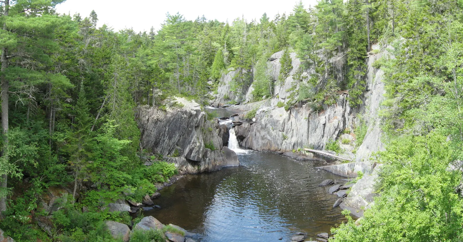
Places where people swim. Depths change with the water level, so never jump or dive, never get in above a falls, and never swim right under a falling cascade.
- Frenchman’s Hole, Newry
- Smalls Falls, Township E (the lowest pool only)
- Coos Canyon, Byron
- Rattlesnake Flume and Pool, Stow
- Houston Brook Falls, Pleasant Ridge (shallow, better for wading)
- Calm pools in low summer water inside Gulf Hagas (Billings Falls pictured); it is remote, with fast chutes and no lifeguards, so most visitors enjoy it from the rim
More detail in our best swimming holes in Maine guide.
- Water
- Most pools stay in the 50s, even in August
- Gulf Hagas
- Remote; calm pools in low water only
Best Hike-In (Real Effort Required)
For the reader who wants to earn it:
- Angel Falls, Township D (rough road plus 1.1 miles round trip with stream crossings)
- Dunn Falls, Andover North Surplus (2.5-mile loop)
- Gulf Hagas Falls system (3.5 miles to Screw Auger Falls, 8 for the full loop)
- Poplar Stream Falls, Carrabassett Valley (about 4 miles round trip)
- Katahdin Stream Falls, Baxter State Park (about 2.4 miles round trip)
Most Photogenic
The ones that dominate Instagram:
- Angel Falls for its tall thin ribbon
- Screw Auger Falls for the carved potholes
- Smalls Falls for multi-tier composition
- Moxie Falls for sheer height
- The Jaws at Gulf Hagas for its narrow canyon walls
Best for Kids
Short walks, safe viewing, something interesting to do:
- Screw Auger Falls: short path, potholes to look at (not wade in)
- Snow Falls: fenced gorge seen from a bridge, picnic tables
- Coos Canyon: gold panning, shallow pools
- Smalls Falls: footbridge, picnic tables, easy viewing
- Houston Brook Falls: short, easy trail
When to Visit Maine Waterfalls
Flow, water temperature and crowds change everything. Here is the rough calendar:
Peak flow Best
April to mid-MaySnowmelt turns even minor cascades into roaring columns. The water is freezing, and higher trails are muddy or still snowy. This is the photographer's season.
Early summer
Late May to JuneFlow tapers and trails dry out. Black flies peak in early to mid-June in the western mountains and big woods, so bring a head net.
Swimming season Best
July and AugustPools clear and some warm into the 60s. Moxie and Angel hold their flow while small falls thin out. Smalls, Frenchman's Hole and Coos Canyon are crowded by 10 AM on weekends.
Foliage Best
September to early OctoberFlow is low, but color frames every shot. Mid to late September is the sweet spot around Rangeley and Grafton Notch. Foliage weekends draw big crowds, but they are gone by the weekday after Columbus Day.
Ice
November to MarchIce formations on the bigger falls, and icy trails to reach them.
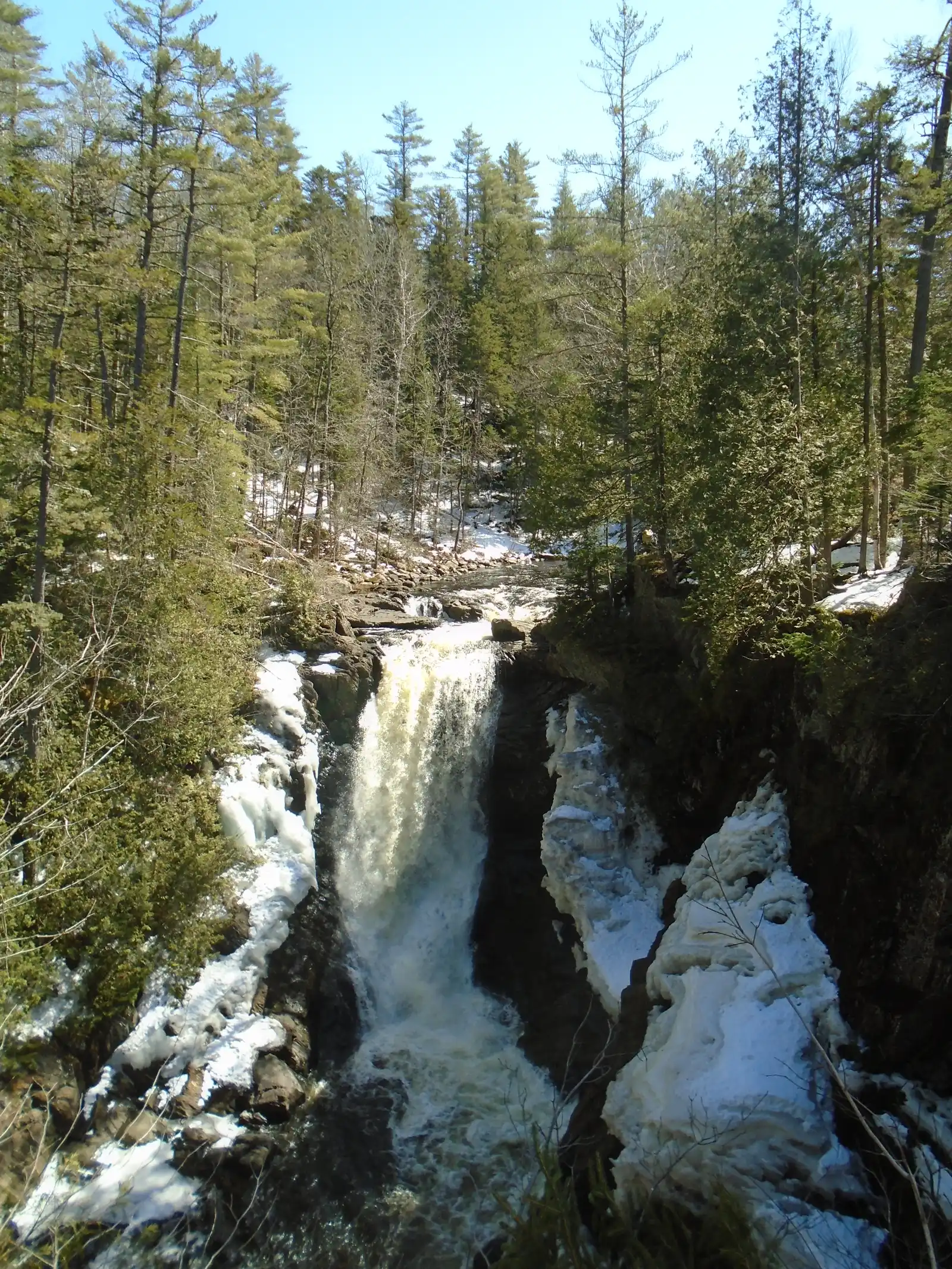
Experienced winter hikers go to Moxie and Smalls to photograph frozen cascades. This is not a casual-tourist trip: you need traction devices, cold-weather gear and comfort on icy trails.
- Winter picks
- Moxie Falls and Smalls Falls
- Who it suits
- Experienced winter hikers only
Check USGS stream gauge data before driving to any waterfall for photography. High flows after rain can be dramatic but often muddy. Very low flows in August can leave some of the smaller cascades as a trickle. Gauges on the Bear River, Swift River, Sandy River, Pleasant River, and Dead River will tell you what you are going to find.
Safety
Waterfalls cause serious injuries and drownings. Three hazards to know:
- Slipping on wet granite near the top of falls. Wet stone below cascades is coated in algae and is as slippery as ice. Stay behind barriers; do not climb out to “get a better shot.”
- Jumping and diving. Plunge pools that look deep often have hidden rocks, and depth changes with the flow. Don’t jump or dive.
- Fast-rising water. Mountain streams can rise quickly after heavy rain and during spring snowmelt. If the water is rising or turning muddy, leave right away.
Cold water shock is also real. Most Maine waterfall pools stay in the 50s Fahrenheit even in August. A sudden fall in can make you gasp and breathe hard, and the National Weather Service warns that within 10 minutes you can lose the muscle control you need to swim or climb out.
Frequently Asked Questions
What is the biggest waterfall in Maine?
By height, Moxie Falls in The Forks and Angel Falls near Rangeley both measure around 90 feet and are the tallest single-drop falls in the state. Rumford Falls drops 176 feet in total but over multiple tiers within an urban setting. By water volume, Grand Falls on the Dead River is one of the biggest, a 40-foot horseshoe more than 100 feet wide in remote country near The Forks.
Where are most of Maine's waterfalls?
The Western Mountains region, the stretch running from Grafton Notch through Bethel, Rumford, Rangeley, and up to Carrabassett Valley. 19 of the falls in this guide are there. Grafton Notch State Park alone has two well-known falls, Screw Auger and Mother Walker, a few miles apart, and Step Falls is just outside the park.
Are there waterfalls in Acadia National Park?
Not significant ones. Acadia's terrain is coastal granite with limited watersheds, so the park has no famous waterfalls. If you are in Acadia and want to see a waterfall, the closest good options are a couple of hours west in the Moosehead or Western Mountains region.
What is the easiest waterfall to see in Maine?
Screw Auger Falls in Grafton Notch State Park. A roadside parking lot on Route 26, then about 100 yards on a maintained path with guard rails to the overlook. The state park charges a small day-use fee. Coos Canyon in Byron is equally easy and free.
Can you swim at Maine waterfalls?
At some, yes. People swim at Frenchman's Hole, the lowest pool at Smalls Falls and Coos Canyon, wade in the shallow channel below Houston Brook Falls, and some cool off in calm pools inside Gulf Hagas in low summer water. Screw Auger Falls and Angel Falls have shallow or dangerous pools and are not for swimming despite how they look. There are no lifeguards anywhere: never jump or dive, never get in above a falls, and never swim directly beneath an active waterfall.
When is the best time to photograph Maine waterfalls?
Late April through mid-May for peak flow, and mid-September through early October for foliage-framed shots. Spring gives you maximum water drama. Fall gives you color. Summer is lower flow and harsher overhead light.
Are Maine waterfalls free to visit?
Most are. Free spots include Smalls Falls, Coos Canyon, Snow Falls, Houston Brook Falls, Frenchman's Hole, and Rumford Falls. Grafton Notch State Park (Screw Auger, Mother Walker) charges a small day-use fee. Gulf Hagas charges the KI Jo-Mary day-use fee, paid at the Katahdin Iron Works checkpoint run by North Maine Woods. Baxter State Park charges a non-resident entry fee for Katahdin Stream Falls access.
Which waterfall is best for a first-time visitor to Maine?
Screw Auger Falls in Grafton Notch State Park. Easy access, small entry fee, photogenic, and paired with two other nearby waterfalls (Mother Walker and Step Falls just outside the park) for a half-day waterfall tour. Throw in Frenchman's Hole on the same day and you have seen four of the best waterfalls in Maine in a single afternoon.
Plan Your Waterfall Trip
- Pick a base Most visitors start in Bethel or Rangeley. Both sit in the middle of the Western Mountains, within 30 minutes of several waterfalls.
- Add a swim Pair waterfalls with swimming in our best swimming holes guide.
- Gulf Hagas or Baxter Read the Gulf Hagas trail guide first. In Baxter, Katahdin Stream Falls is an easy stop on any park trip.
- Drive Routes 17 and 4 Coos Canyon and Swift River Falls sit on Route 17, and Smalls Falls is on Route 4 south of Rangeley. The Rangeley region guide covers both roads.